• Skip to main content
  • Skip to primary sidebar
  • Skip to footer

Stepping Out Of Babylon

Travel & Photography

  • About me
    • Contact
  • Destinations
    • Africa and Middle East
      • Iran
      • Morocco
      • Turkey
    • East Asia
      • China
      • Japan
    • South Asia
      • India
      • Nepal
      • Sri Lanka
    • Southeast Asia
      • Cambodia
      • Indonesia
      • Lao
      • Malaysia
      • Myanmar
      • Singapore
      • Thailand
      • Vietnam
  • Itineraries & Maps
  • Travel tips
    • Visa
    • Hiking and Natural parks
    • Traveling as a vegetarian
    • Border crossing
  • Shop & Photography

Natural Park

Yakushima… like a dream!

Looking for a magic place?!?! Japan has a lot of beautiful landscapes, but Yakushima Island exceeded expectations. It’s like a dream, a fairytale…

Shiratani trail

By some mysterious reasons, there are places, located a thousand kilometers away at different latitudes, that look that are connected by a strange bound, sharing the almost the same scenery and offering similar experiences… like the Living Root bridges of Nongriat, in India and the Mossy Forest of Gunung Brinchang, in Malaysia.

Shiratani trail

Yakushima, an island located south from Kagoshima Prefecture don’t have more than 100 km perimeter if you go along the road that goes all around the island, and its basically mountains, covered by a dense green forest, where the populations only occupy some small places along the coast. All the interior of the island remains almost untouched.

Basically there only two roads that go inside the island: one to Shiratani Unsuikyo Ravine and the other one to Yakusugi Land, that also gives access to Arakawa trail, to reach the famous Jomon Sugi (the oldest tree in the island, and one of the oldest in the world) that is also the highest peak on Yakushima, at an elevation of 1,934 m.

Shiratani trail
Shiratani trail

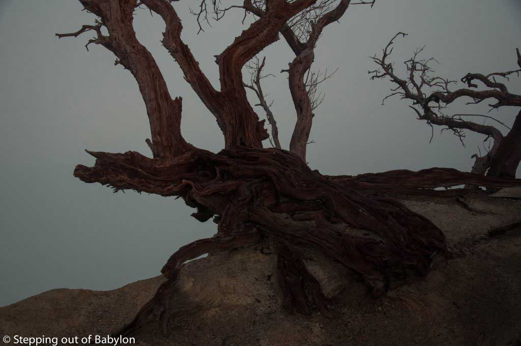
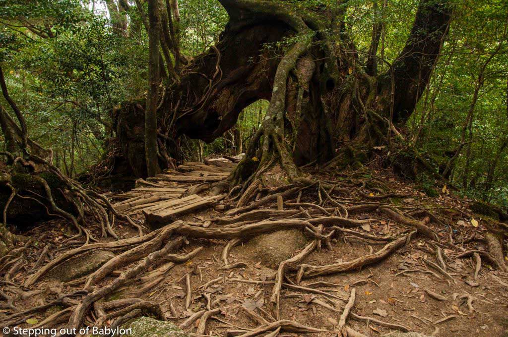
This island is basically all covered with cedars trees and here you can find specimens with more than 1000 years, and the oldest are sign along the trails. One of the most famous, apart from Jomo Sugi, is the Kigensugi Cedar that has an estimated age of 3000 years, or the Buddha Cedar with 1800 years.

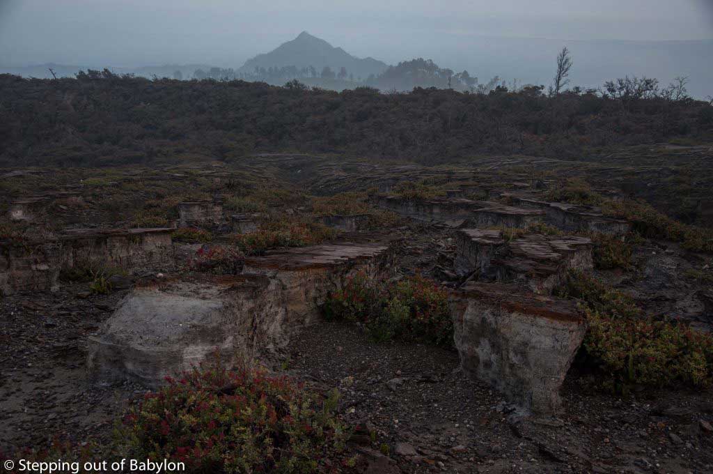
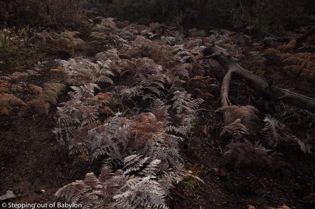
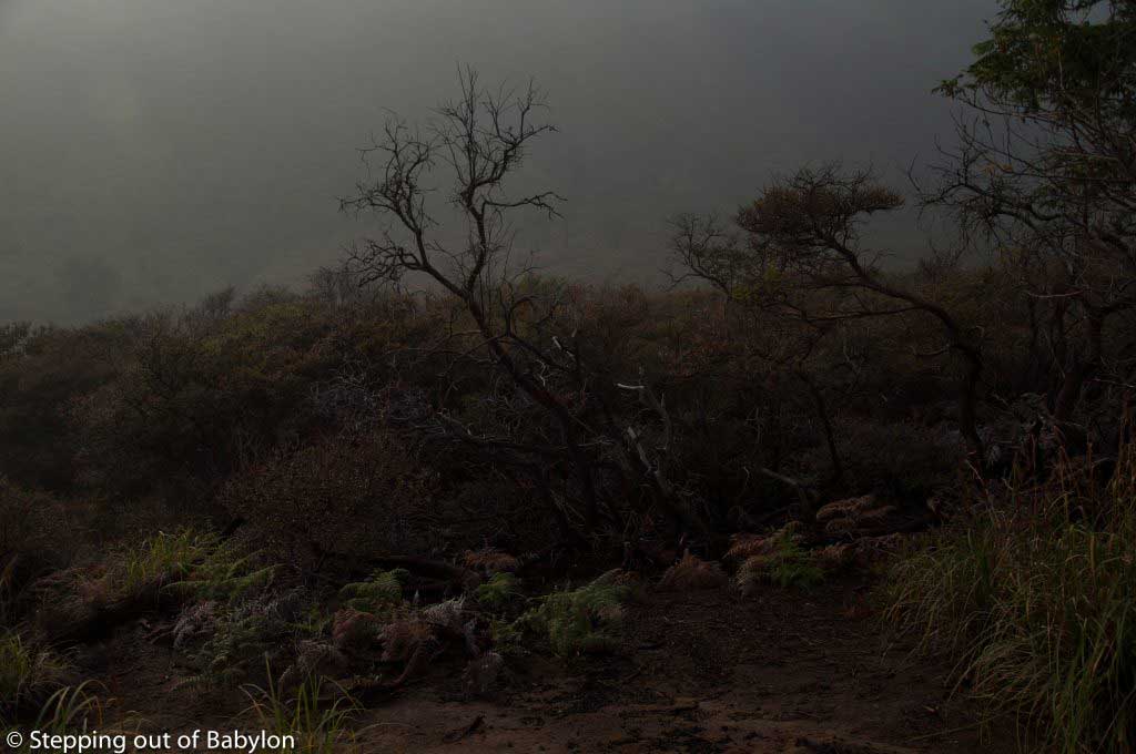
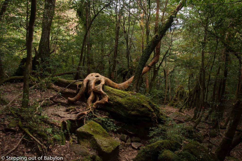
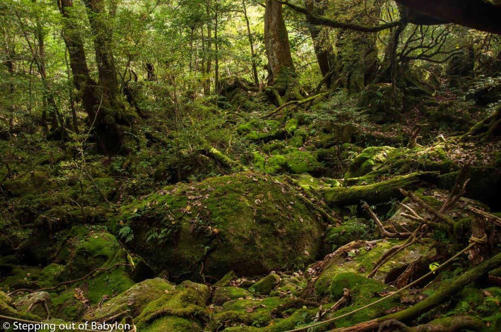
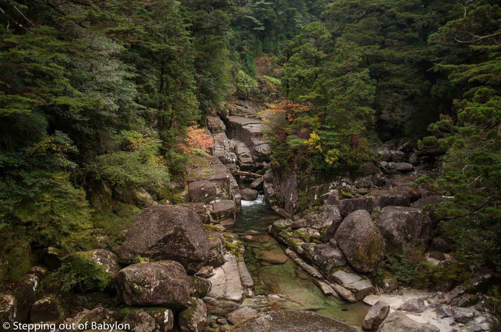
The Shiratani is famous for the moss covered forest, an area with more humidity (even more than the rest of Yakushima), but walking further you can reach a high point the Taikoiwa Rock from where you can have a wide view… and see finally the sunlight (in a clear day) as the forest here is so dense that is hard to see the sun!

Shiratani trail
Shiratani trail

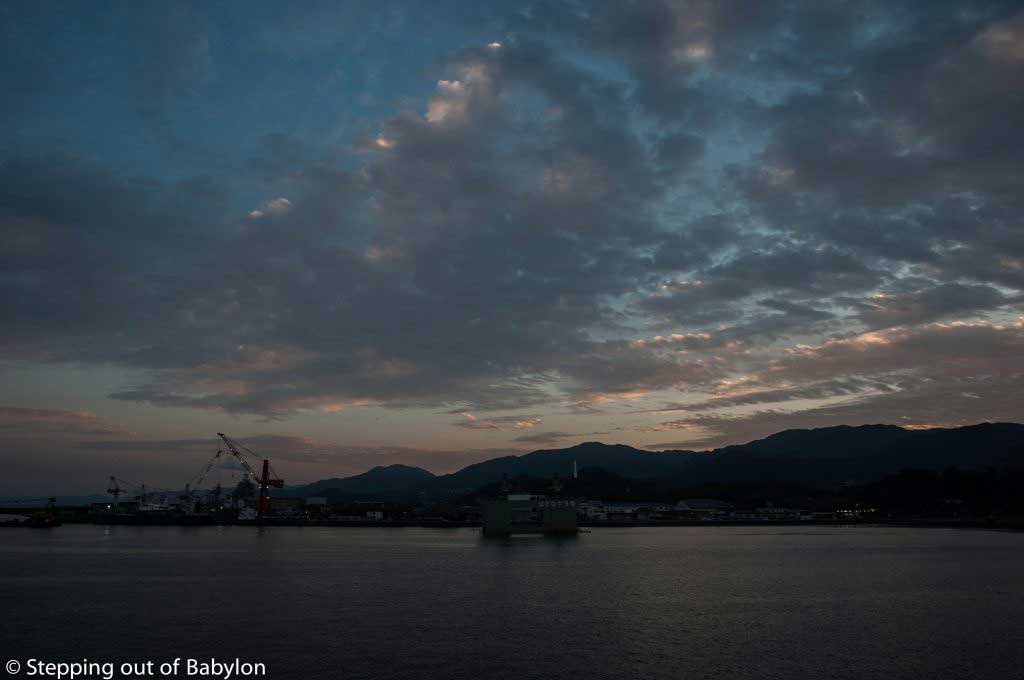
The main village in Yakushima is Miyanoura and is where you’ll arrive if you choose to come by ferry (the Yakushima 2 or the Hibiscus). Here is also where you can find a bigger concentration of restaurants and supermarkets, as well the tourist information (there also one Tourist office at the exit of the airport as also close by Anbo harbor).

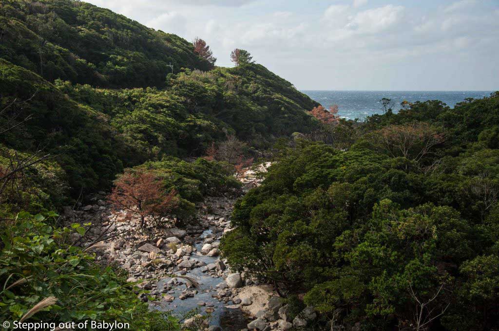
To visit Ohkono-taki waterfall, you only have one bus that goes there. Its departure from Miyanoura at 8:41, arrives at 10:22 and returns from the waterfall at 11:00. So this is the only schedule possible, otherwise, you need to walk from the previous stop Kuriobashi. It´s time enough to visit the waterfall.

On the way back I stop at Nakama beach and also check the Nakama Gajumaru Banyan, a group of ficus trees whose roots are connected, forming an arch. It’s nothing impressive especially after you walk along the Yakushima trails, and force you to break the bus trip from Ohkono-taki waterfall, forcing two hours waiting for the next bus.

Shiratani Unsuikyo Ravine trail

  • One way: departure at 8:10 and arrives at Shiratani at 8:45… but you don’t need to start so early and there’s a more convenient bus at 10:45, that allow you to hick all the courses and finish on time of the last bus.
  • Return: the bus’s last departure from Shiratani at 16:10 and take about 30, to arrive at Miyanoura.
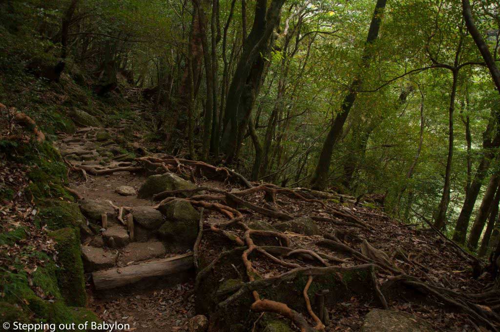
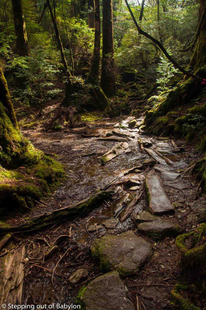
  • There are 3 trails in Shiratani. The longest takes you to the Taikoiwa Rock, passing by the moss covered forest and is the most interesting of all. The other long trail, takes you to the Sanbon-yarisugi cedar, passing by several of very old cedar trees. The short course it’s very easy as most of it is steps and paved trail to reach the Yayoisugi Cedar.
  • This is a good option if you arrive at Yakushima early in the morning in the Hibiscus ferry, as it gives time to reach the guesthouse, get information in the tourist office (open at 9am) as well the bus pass and still have time to go to the supermarket (also open at 9am, and it’s close from the tourist information building) to buy some food for the hick.
  • Fee for Shiratani Unsuikyo Ravine: 500 ¥
Yakusugi Land

Yakusugi Land trail plus the visit to Kigensugi Cedar, 6 km further

In fact, Yakusugi means trees with more than 1000 years old and in this area there a big concentration of these old cedar trees.

Inside Yakusugi Land you have five different trails, a couple of them with about 1km, that are paved and easy to walk; the longest one as 4.4km, basically going up and down the hills using the tree roots as steps. The longest trail includes almost all the length of the shorter ones. It’s an easy walk that took me 4 hours with several stops for photos and to enjoy the views.

But after doing the long trail I realize that I wouldn’t have time to reach Kigensugi Cedar on time to catch the last bus to return. So hitchhiking and was lucky with one of the few cars that do that road.

If you are in Miyanoura, these are the possible bus schedules to visit Yakusugi:

  • One way: departure at 8:41, and change at Gochome at 9:20 to another bus that reachs at Yakusugi at 10:07.
  • Return: departure at 15:15, arrive at Gochome at 15:58, and then you need to wait until 16:32 for the bus to Miyanoura.
  • This schedule allows you to walk along all the trails without a rush. You can also start later (12:51) or leave from Yakusugi earlier (11:05).
  • Fee for Yakusugi Land: 500 ¥

But the most famous trail is Jomo Sugi, an 11.5 km trail that reaches the 1300m, starting in Arakawa. It takes all day, and in the wintertime the days are short… so I didn’t’ even try… maybe next time. You need to departure from Miyanoura (this bus starts at Sea Side Hotel, stop number 19) around 4:45 to catch the fist bus to Shinenkan, and there change bus at 6:00 to Arakawa Tozanguichi that takes just 35 minutes. To return you must be at the bus stop at Arakawa at 15:30… maybe too short to hike 11 km!??!?

Yakusugi Land
Yakusugi Land

Onoaida Onsen:

There is about 8 onsen (natural hot springs) in Yakushima, most of them are in the sea… as it was November, thes options didn’t show up much pleasant, despite the winter in Yakuhima being more gentle that in other parts of Japan.

But couldn’t resist to visiting twice the Onoaida onsen, located on the south coast of Yakushima, being the most famous of all the onsen between the local population. The poll isn’t that big, but the water is so warm that no one can stay there for more than a couple of minutes. You can see the bubbles from the sulfur hot spring coming from the bottom of the poll between the basalt pebbles.

Here people use more the water from the hot spring to wash rather than using the shower, pouring buckets of water over the body from the pool.

Onoaida onsen is located a bit away from the main road, close by the forest, but doesn’t have any exterior pool. The building, all made in wood with a high ceiling, where the floor and wall are covers by the black volcanic rock, offers a cozy ambiance, where you can try to interact with the local population, and relax from a hiking day!!

I also try the Kusugawa onsen but doesn’t recommend, is it’s more like a public bath with warm tap water, in a dodgy building.

After a hike, there’s nothing better than a very hot bath, and the onsen provides that treat!!!! You end up almost melting on the way back to your guesthouse.

Fee: 200¥ but you need to bring a towel and soap.

Nakama beach

How to move around Yakushima by bus:

In fact, the main issue that I face in Yakushima was transportation. Some buses go around the island, from Nagata to Ohkono-taki waterfall, but they are not very frequent with sometimes gaps of 2 hours and finish very early.

So this can really be an obstacle to explore the island, making short hikes of 4 hours, like Yakusugi Land and Shiratani-trail, take you all day, as you probably need to wait more than one hour for the bus back. So basically you need one day for each of the trails… and depending on your location, and one extra day more to the visit the Ohkono-taki waterfall.

Here is some info about buses in Yakushima:

  • Kotsu Bus 
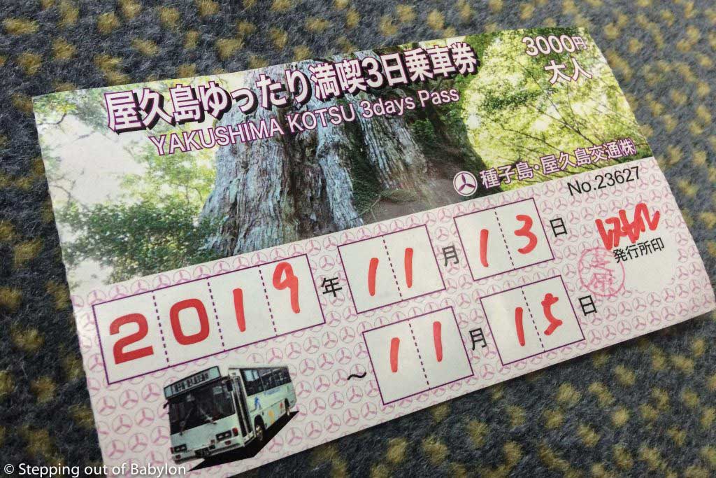
Pass: the bus is the only way to move around Yakushima, but this service é scarce, with several places having only two buses a day. Apart from that, the bus is expensive, as a trip around the island (from Okonotaki waterfall to Miyanoura) costs 1900 ¥. So it’s better to get the bus Kotsu Pass, that allows an unlimited number of trip, with several options:
    • 1 day: 2000 ¥
    • 3 day: 3000 ¥
    • 4 day: 4000 ¥
  • You can get the Kotsu Bus Pass at the Information office of Miyanoura, Ambo Port and the Airport; at Miyanoura, the Yakushima Visitor Center (a kind of souvenir shop located on the left side of the main road, about 100m further from the Information Center, but this shop opens earlier, at 8 am) and also at the Youth Hostel.
  • It’s easy to navigate by bus as all the stops have a number that is also in the bus schedule.

More information about the bus schedule at:

//yakukan.jp/doc/pdf/2019gw_yakuko_en.pdf

Where to sleep in Yakushima:

I choose to stay at Miyanoura. It’s not a charming place but it very close to the harbor, which reveals convenient when arriving and departures as you don’t need to de dependent on the buses. Miyanoura, wherever you stay, it’s a walking distance from the harbor.

I stayed at Sudomari Minshuku Friend, It’s a local guesthouse, with traditional Japanese shared rooms, some with beds others with tatamis. A quiet place where I felt at home. Laundry is for free and you can use the kitchen. The manager is very friendly but doesn’t speak much English, so you can’t count much on him to get help with how to move around. It’s continentally located just in front of one Kotsu bus stops and it’s about 1.2km from the Hibiscus Ferry port. 3300 ¥ a night.

Where to eat in Yakushima:

As an Island, Yakushima speciality is the fish, and there are several restaurants in Miyanoura, but some of them only open for lunch.

The supermarket (there are two) are a good option if you need to buy food for the hiking. Some places offer bento box but the price is a bit high.

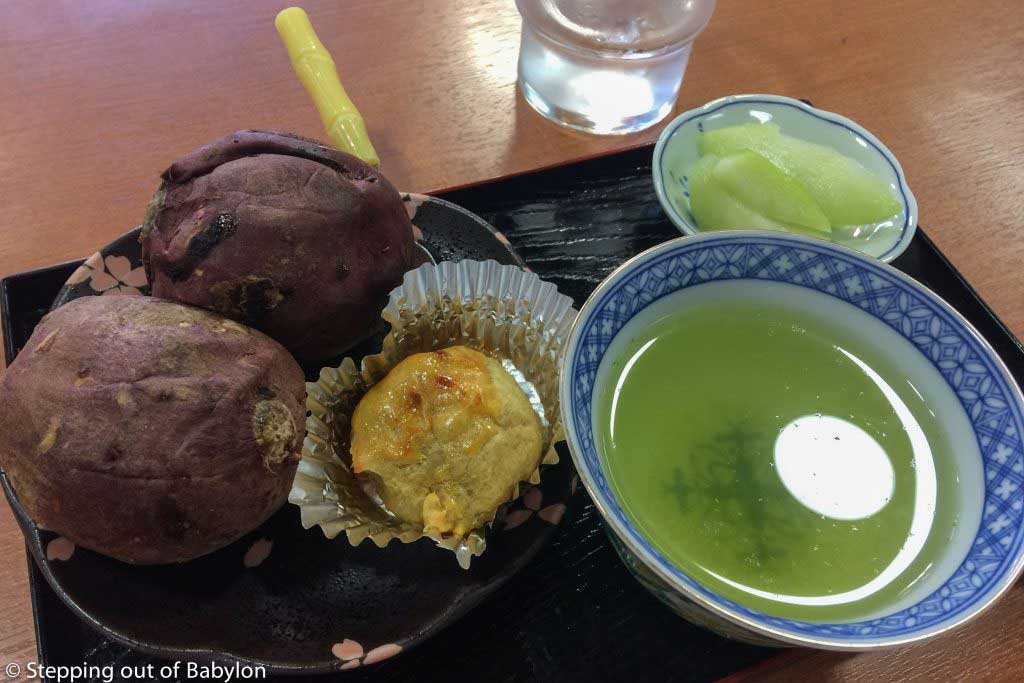
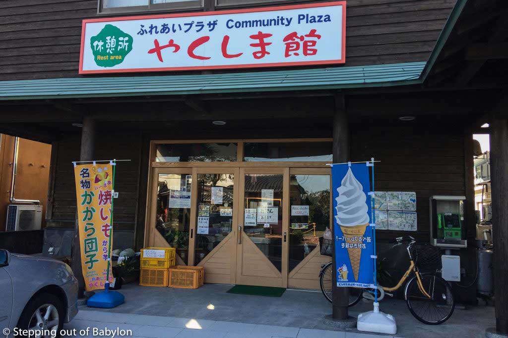
At the Community Plaza, a small shop located a few meters further from Sudomari Minshuku Friend Guest House, they serve also food for a very cheap price. The usual dish is curry (meat) but if you are in the mood for a snack you can try the sweet potato set, that also include a tea and a delicious sweet, also made form sweet potato… only 100 ¥ (it closes around 4pm).

Things to know when you arrive at Yakushima:

  • The tourist information in Miyanoura, that you gonna find on the right side of the road when you leave from the harbor, has the door closed with a sign “closed today”; go around the building (along the left side), as the main door is the opposite side; the Information office is open from 9 am until 5 pm, everyday. Here you can get the maps of the trails, the bus schedule as also the Kotsu Bus Pass.
  • There are two big supermarkets at Miyanoura, and they are open from 9 am until 10 pm; there you can find ready-made meals for taking away.
  • Money: It’s better to get cash before the trip, as in Yakushima the only ATMs are in the post office spread along the island, but they charge 220 ¥ commission for each withdraws.

How to reach Yakushima by ferry boat:

steppingoutofbabylon.com/en/2019/11/how-to-go-from-kagoshima-to-yakushima-by-ferry/(opens in a new tab)

Ijen Volcano and Banyuwangi

Emptiness, desolation, silence, void… some words that are not enough to describe totally the feeling inspired by the landscape that surrounds the Ijen Volcano, which activity contributes to producing high quantities of sulphur, a mineral that is collected from the bottom of the crater by men.

Since early morning these miners, carry baskets on their shoulder with the big blocks of sulphur, which shiny yellow color contrast with the monochrome landscape. This concentration of sulphur is also responsible for a phenomenon called the “blue fire” only visible during the night, that is the combustion of the gas released by the volcano. Due to the recent eruption (March 2017) the crater is filled with smoke and the visitors are not allowed to go down, so the “blue fire” is not really visible.

The fire is not visible but the smoke that comes out from the crater, slowly start to irritate the throat and the eyes, making the breath heavy and leaving an intoxication sensation, that increase at dawn, when the air starts warming up. It’s strong enough to force anyone to use the gas mask, making your breath an audible experience that reminds Darth Vader, where the almost desert landscape creates a hash scenario.

Workers don’t use a gas mask but I think is more an option, maybe due to the lack of awareness of the impact of sulphur in health, than by economical reasons, as the same miners hang around selling mask to the visitors. But these miners suffer from the sulphur expose that reduces their life expectancy to less than 50 years.

[clear]

Kawah Ijen... the most acidic lake in the world
Kawah Ijen… the most acidic lake in the world

[clear]

[clear]

Kawah Ijen
Kawah Ijen

[clear]

Kawah Ijen
Kawah Ijen

[clear]

sulfur rocks carried by the miners
sulphur rocks carried by the miners

[clear]

Ijen Volcano
Ijen Volcano

[clear]

[clear]

But the Ijen has much more to offer: Kawah Ijen, another crater filled with water that due to the concentration of sulphur results on the most acidic lake in the world.

As the sun comes out behind the mountains that surround Ijen, the mist that fills the crater starts to slowly dissipate, revealing the fantastic colours of the lake, that goes from the greenish to a bluish color, with a milky appearance. Something hard to describe as everything looks unreal and illusory. And is not just the lake… as the soft first light of the day illuminates the sky, a fantastic landscape starts to show up, revealing a scarce almost all burned by the acid steam that comes from the lake, and a soil where the erosion of the acid waters brought by the rain leaves deep marks like ditches made by a gigantic claw.

The soil on the top of the Kawah Ijen also gets unusual colours with yellowish traces resulting from the acidic lake waters.

[clear]

Ijen Volcano
Ijen Volcano

[clear]

Ijen Volcano
Ijen Volcano

[clear]

Ijen Volcano
Ijen Volcano

[clear]

Ijen Volcano
Ijen Volcano

[clear]

Ijen Volcano
Ijen Volcano

[clear]

But the most remarkable moment from this visit, was the hike just before the sun rises up, where the dawn light, still dim to light the path I was walking, but strong enough to cut out the shape of trees and bushes which naked branches create phantasmagoric black figures against the dark blue sky. The absence of sounds, the immobility of the air and the fantastic landscape wrap us in a surreal reality… like a dream coming from another dimension.

[clear]

the way to Kawah Ijen at dawn

[clear]

the way to Kawah Ijen at dawn

[clear]

the way to Kawah Ijen at dawn

[clear]


How to visit Ijen Volcano:

  • You gonna need transport from Banyuwangi to Pos Paltuding the entrance of the Ijen Park: rent a motorbike or get an ojek (200.000 Rp return). If you want to see the sunrise and reach Ijen by ojek you need warm clothes as the trip is made around 2 a.m. and is really cold, even if at Banyuwangi is a warm night. If you drive a motorbike, go with plenty of time, as a few parts of the road are in bad condition… is a long way to the top made in darkness, so you must feel confident as a scooter driver. The way down is steep and a bit danger!
  • You gonna need a gas mask… really!!! It will cost 40.000 Rp at the entrance. The sulphur gas can be strong, depending on the winds, irritating the throat, lungs and eyes, making the hiking more difficult… although you just feel it nearby the crater and on the way to the lake. Around the lake, thesulphur is not significant.
  • You need to buy the entrance ticket: 100.000 Rp. At the weekends and public holidays, the ticket costs 150.000 Rp.
  • You do not need a guide!!!!! The doors open at 3:00 a.m. and everybody that arrive by a tour start hiking at the same time, so you just need to follow the crowd… and anyway the path is wide and very clear, as it used by the miners to transport the sulphur stones in hand cart. This hike takes about 90 minutes to reach the “blue fire” crater.
  • You gonna need a flashlight!!! The stretch between the blue fire crater and the Ijen Lake is not so clear and probably you’ll do it still before dawn, and at this point the tour groups will split a bit and there’s not a crowd to follow. If you don’t travel with one ask at your guesthouse.
  • Warm clothes. When you reach Pos Paltuding the temperatures are low during the night is even more on the top around the crater, maybe 10 degrees C. But with the hike quickly you’ll be sweating and need to get rid of some layers of clothes to put them on again when you reach the top. But on the top, around 8 a.m. is still very cold, and at that time my hands were almost without sensitivity.

If you choose a tour, they all stat from Banyuwangi around 1:00 a.m., moving around to pick others tourists and arriving at the Ijen park entrance (Pos Paltuding) around 2:30 a.m. There you find eateries with snacks, food and drinks… and some warm clothes.

The gates open at 3:00 a.m. with all the groups moving at the same time.

The visit usually ends around 7 or 8 a.m., depending on the guide and the speed of the group… I arrive at Banyuwangi around 9.30 h.

[clear]

miners selling sulfur souvenires to the tourists
miners selling sulphur souvenires to the tourists

[clear]

Due to the recent eruption (March 2017) the crater is filled with smoke and the visitors are not allowed to go down, so the “blue fire” is not really visible, and doesn’t make much sense the tours start so early (1 a.m. from Banyuwangi)…. but this information is not released by the people that are organizing or selling the tour and not even by the guides.

[clear]

Note: since March 2017, after an eruption of the Ijen volcano, the way down to the crater is closed for visitors, that makes almost impossible to see the so-called “blue fire” as the smoke result from the volcano activity fills the entire crater.


[clear]

Banyuwangi:

This city, at the most eastern point of Java, doesn’t offer much to see or to do and basically serves as a base point to visit the Ijen Volcano. Most of the people arrive here during the day, sleep a few hours and after visiting Ijen leave to Bali or Bromo.

Banyuwangi is also a waypoint for those traveling from Bali to Java, by ferryboat, that means from the Gilimanuk to Ketapang (Java) located a few kilometers from Banyuwangi.

I walk a bit around but couldn’t find anything that catches my attention, but the people are very friendly and smiley, making this uncharacteristic place a warm welcome to Java!

[clear]

Banyuwangi
Banyuwangi

[clear]

Banyuwangi
Banyuwangi

[clear]

Banyuwangi
Banyuwangi

[clear]

Where to sleep in Banyuwangi:

I stay at Pepito Guest House, that isn’t a remarkable place but has a good price, with a room with toilet costing 100.000 Rp, and with a delicious breakfast (Javanese style) made by the “auntie” that lives next door (maybe the best memory from Banyuwangi). Friendly staff that will help you to move by local transportation and that can also arrange a tour for a “not-so-expensive” price… 300.000 Rp, including transport, ticket and mask…. and a guide that you don’t need!

Pepito Guest house

Address: Jalan Jaksa Agung Suprapto No.159, Banyuwangi

Phone: 0813-3627-8367

Some rooms can be a bit noisy, and others without windows, so check the options available… and don’t trust much when the reservation sites say that there is “just one more room free”… if you arrive after noon probably all the rooms will be free, as most of the people just check out on the same day that visited the Ijen. You can call them if you want to book!

[clear]

[columns] [span6]

Pepito Guest house. Banyuwangi

[/span6][span6]

Pepito Guest house. Banyuwangi

[/span6][/columns]

[clear]

Where to eat in Banyuwangi:

Along the Jalan Jaksa Agung Suprapto, there are many eateries that sell food, the usual variation of nasi. Just next door of Pepito Guest House there is also one shop that opens after 5 p.m. selling food packed in paper cones.

A meal in one of these places costs around 10.000 Rp and is usually tasty and spicy.

[clear]

ATMs and Money exchange in Banyuwangi:

I couldn’t find moneychanger at Banyuwangi.

But during my search, one helpful and friendly man drove me to the BCA Bank, at Jalan Jenderal Achmad Ysani. Usually, the banks don’t offer an attractive rate but the BCA at Banyuwangi, gave me a good deal and doesn’t charge commission. It takes more time, as you need to fill a form, show the passport and wait for your turn, but the friendly staff made all this very smooth.

[clear]

Money changer at BCA bank,

[clear]

How to go from Banyuwangi to Cemoro Lawang (Bromo Volcano)

  • Bemo number 8 (yellow bemos that pass by Jalan Jaksa Agung Suprato) from Banyuwangi to the Karangasem Train Station, the trip takes about 5 minutes and cost 5.000 Rp
  • Train from Karangasem to Probolindo. Is better by the ticket in advance otherwise, you probably will not find economic ticket. I got mine one hour before the train departure and only found a seat in business class (120.000 Rp). There’s one train departing from Karangasem at 9:15 a.m. that arrive at Probolingo at 13:15. Watch out: Probolingo is famous for scams!
  • In front of the Probolingo Train Station, you’ll see a yellow bemo waiting that goes to the Bus Terminal Bayu Angga. You need to wait until it get’s full and the trip costs 10.000 Rp and takes 15 minutes. Along the way, the driver stopped several times trying to push the forigners out of the bemo, saying that in that place we’ll catch the bus to Cemoro Lawang, but these are the private buses or private cars. The public buses (very old and in bad condition) are waiting a bit south from the Bayu Angga Terminal, in front of some warungs. The driver will spot you as everybody that arrives here go to “Bromo”. The ticket costs 35.000 Rp and you need to wait until the bus is full, that means 15 people. If after a while there are not enough people, the total cost of 525.000 Rp will be divided by the number of passengers
  • The 37 km until Cemoro Lawang are made along a bumpy road with nice views passing along rural areas. It takes 1.5 hours.
  • The bus drops you at the end of the road, or before if you ask, as there is not exactly a center of the village, very close from the starting point of the hiking to reach the sunrise viewpoint.

Bako National Park

Bako is Malaysia’s oldest National Park, established in 1957 and takes its name from the muddy river nearby which flows into the waters of the South China Sea.

Even before arriving at the park, the route taken by the river provides a memorable landscape with the soft morning light shining on the almost still waters of the river Bako, which forms a mirror that merges with the sky and where the skyline fades in presence of a thin layer of mist that emanates from the hot waters of the river.

There are several possible paths to be covered in a day trip, and others that require more time to dwell at least one night in the park. During this visit* the western part of the park was closed to visitors, but the one third that is open offer many options, with 10 possible tracks.

The choice was to Litang Trail with 5.8 kilometers and that it was done in about three hours that left time to do part of the trail to Telok Paku, which despite its simple ones 800 meters has more obstacles and takes a long time.

The Litang Trail is what goes over the forest, with diverse landscapes, from dense and humid jungle, until hot and dry rocky plateaus. As November is already time of much rain the track was soaked in water, but not muddy, as soil is predominantly sandy. Towards the end of the course,

The Telok Paku is offering more chances to observe wildlife especially Proboscis monkey, but given the number of visitors, some quite noisy, the chances of observing animals is reduced, beyond ants and small insects.

Bako National Park. Sarawak. Borneo


Bako National Park. Sarawak. Borneo


Bako National Park. Sarawak. Borneo


Bako National Park. Sarawak. Borneo


Bako National Park. Sarawak. Borneo


But what truly marked this visit was the route at Litang Trail, where during about three hours, I could walk through the wilderness without finding other visitors and can thus enjoy a more intense contact with nature, in which the mind focused on the walk, on foot movement and on rhythm of the breath, gets empty of thoughts.

In total isolation the jungle noises bring the fears and ghosts that we try to hide with the frantic pace of life, making the forest show us his danger and spooky side. But accepting the power of nature we are conducted and cherished by the energy and power that emanates from these trees, making us feel part of this magic that we call Nature. Mother Nature.

This was the most interesting and impressive experience in natural parks, leaving an intense memory of those hours spent in close contact with the jungle. A bless provided but the deep forces of the jungle.

* November 2015

Litang Trail. Bako National Park. Sarawak. Borneo


Litang Trail. Bako National Park. Sarawak. Borneo


Litang Trail. Bako National Park. Sarawak. Borneo


Litang Trail. Bako National Park. Sarawak. Borneo


Litang Trail. Bako National Park. Sarawak. Borneo


Litang Trail. Bako National Park. Sarawak. Borneo


Litang Trail. Bako National Park. Sarawak. Borneo


Litang Trail. Bako National Park. Sarawak. Borneo


Litang Trail. Bako National Park. Sarawak. Borneo


Litang Trail. Bako National Park. Sarawak. Borneo


Litang Trail. Bako National Park. Sarawak. Borneo


Litang Trail. Bako National Park. Sarawak. Borneo


Telok Paku Trail. Bako National Park. Sarawak. Borneo


Telok Paku Trail. Bako National Park. Sarawak. Borneo


Telok Paku Trail. Bako National Park. Sarawak. Borneo


Telok Paku Trail. Bako National Park. Sarawak. Borneo


Accommodation:

The Baku National Park is located near Kuching so it can be visited on a day-trip. However it is possible to stay in the accommodations near the park headquarters. It should be reserved.

Where to eat:

At the entrance of the park near the headquarters there is a cafeteria. However for a day-trip just take some fruit and water. Water is fundamental and 1.5 liters per person, is not too much.

Equipment and guidance:

The tracks are fairly easy and affordable, with the hardest part being the first 500 meters that are common to all the tracks, with some steepness overtake by stairs and by paths between tree, roots and rocks.

All trails are well marked with the respective color, painted on rocks and trees shillings, being almost impossible to get lost. The Litang Trail has marks 100 at 100 meters with the distance made, which not only facilitates orientation as also the determination of the effort and the pace of the hike. The final part of the trail, on arrival at headquarters is done on flat wooden platforms.

The Telok Paku Trail doesn’t have these milestones, but is very well defined, with parts of the route on wooden platforms and stairs that facilitate the passage in the steepest areas.

In terms of equipment it isn’t necessary anything special, not even hiking boots. A sneakers, running shoes or sandals works perfectly in this kind of trails. Some parts of the trails have some water that you can’t avoid.

The heat and humidity make you sweat profusely, so all clothing quickly get soaked.

Must bring mosquito repellent as they are a fierce presence in more wetlands route.

Plenty of water to drink.

It is not necessary a guide.

Bako National Park. Map

How to get from Kuching to Bako National Park:

The bus to Bako Park passes in Jalan Market by the Chinese History Museum, but in this place there is no indication or houses to indicate that buses stop here; a little further on, at Jalan Tunku Abdul Rahman in front of the building Riverside Shopping Center there is another stop.

The bus passes at about 7:00 am and the trip takes about an hour.

Bus Ticket: 3.5 RM

The terminal bus route in Bako Bazaar, a small cluster of houses where the reception Bako Park. Here you buy the ticket for the park as well as the ticket for the boat that transports visitors to the official entry of parquet where are the headquartes. The boat is the only way to get to the park and part of a small pier near the reception of the park.

Park fee: 20 RM

Boat: RM 20 one way; the return ticket has to be purchased in headquartes the park and should be purchased in advance for the boats that leave in the afternoon are quickly filled; the last boat is at 16.00).

The boat trip takes about 10 minutes.

If the tide is low the boat does not reach the small pier, taking passengers to disembark on the beach. The same is true in return.

By the headquartes is provided map and all information on the various tracks, including degree of difficulty, duration and length of the course.

In the end it is necessary to book the boat for the return, and pay the ticket next to headquartes.

Buses leave from Bako Bazaar to Kuching every hour, and the last is at 18:00 hours.

Bus Stop in Kuching to Bako National Park in front of Riverside Shopping Center


Bako Terminal
Bako Terminal


Bako National Park. Boat Ticket

Please note: the climate is hot and extremely humid and not always the rails have plenty throughout the length of the course, which causes profuse sweating and fluid loss, so drinking water is extremely important.

Primary Sidebar

Donation…

Sharing is caring… Stepping Out Of Babylon remains free (and without advertisement). It takes me hundreds of hours to research, organize and write… and thousands of euros to sustain.

As I put all my love, effort and ‘free time’ in this project I would love to continue my journey providing all the information to make your trip easier and cheaper… or just inspire you with nice texts and good photos.

If you find any interest and value in what I do, please consider supporting my work with a donation of your choosing, between a cup of coffee and a good dinner.

With Love!

€

Give what you can

Select Payment Method
Personal Info

Donation Total: €5.00

Subscribe to our mailing list and get interesting stuff and updates to your email inbox.

  • 2,127,205
  • 568,946
  • 584

Footer

Products

  • Humble Hindu priest. Bali 35€ – 60€
  • Smoking a thoughtful cigarette. Nagaland 35€ – 60€
  • Tattooed Man. Myanmar 35€ – 60€
  • Ramayama Festival. Myanmar 35€ – 60€
  • Monk at Shwedagon Pagoda. Myanmar 35€ – 60€

Tags

accommodation Arugam Bay Assam Bali Bogor Border Crossing Borneo Cappadocia Colombo Dambulla Esfahan Fes Food Gilis Hiking Imlil Istanbul Itinerary Jakarta Java Kashan Kathmandu Kohima Kuala Lumpur Lombok Marrakesh Meghalaya Meknes Nagaland Natural Park Northeast States Ouarzazate Sarawak Shiraz Sichuan Province Sumatra Tabriz Tehran transportation Varanasi Visa Yangon Yazd Yogyakarta Yunnan Province

search

Categories

  • English
  • Português

Copyright © 2023 · SOOB Infinity Pro on Genesis Framework · WordPress · Log in

We use cookies to ensure that we give you the best experience on our website. If you continue to use this site we will assume that you are happy with it.Ok