• Skip to main content
  • Skip to footer

Stepping Out Of Babylon

Travel & Photography

  • About me
    • Contact
  • Destinations
    • Africa and Middle East
      • Iran
      • Lebanon
      • Morocco
      • Turkey
    • East Asia
      • China
      • Japan
      • Taiwan (ROC)
    • South Asia
      • Bangladesh
      • India
      • Nepal
      • Sri Lanka
    • Southeast Asia
      • Cambodia
      • Indonesia
      • Lao
      • Malaysia
      • Myanmar
      • Singapore
      • Thailand
      • Vietnam
  • Itineraries
  • Travel tips
    • Border crossing
    • Hiking and Natural parks
    • Food Journey
    • Visa
  • Photography

South Asia

Mokokchung… and the boring Sunday!

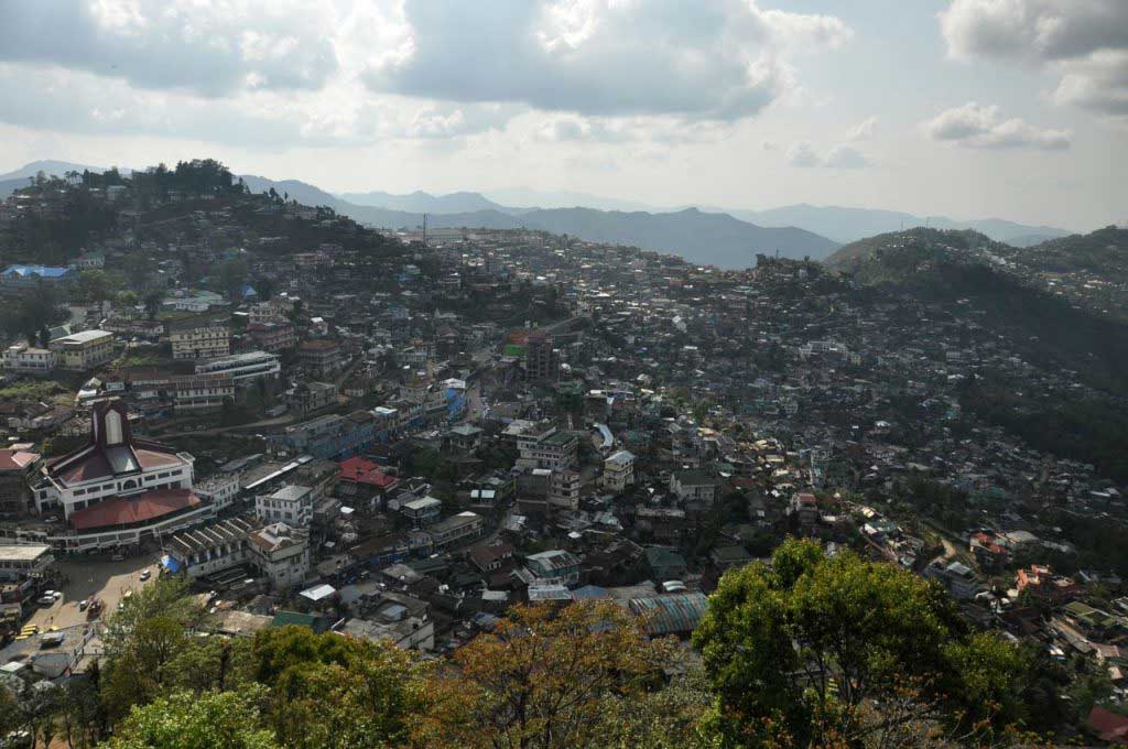
About Mokokchung we can resume that is a banal and boring city. But at the same time has everything to be nice: organized, clean, quiet and with a location that offers a wide view of the green-covered mountains that surround this city. Mokokchung pops up as the culture center of the Ao tribe, one of the several ethnic groups that constitute the state of Nagaland in northeast India.
Mokokchung
Mokokchung

Having started the journey in Nagaland at the top north of the state, by the region of Mon, Mokokchung appeared on the map as an intermediate stopping point on the journey to Kohima, on the south of Nagaland, whose mountainous features always require long trips. But to my surprise, there is no passable road from Mon to Mokokchung inside Nagaland state, being necessary to the neighboring state of Assam, taking advantage of their flat and in reasonable condition roads, then get back to Nagaland, towards Mokokchung or Kohima.

But after the human aridity and the rugged landscape of the Mon region, which left an intense and not that nice memory of the stay at Mon, this second time, with the Ao tribe, ethnically and culturally different from Konyak, the land of Nagas showed another face.

Early on, passing through the village of Tuli, we are greeted by colorful flowers that adorn vases and gardens at houses entrances, as well as plants that appear to arise spontaneously at the roadside. Houses whose wood and bamboo construction, are immaculately groomed, painted in soft colors that blend with the landscape. A landscape also mountainous, but more “soft” with a brighter and fresh green… as if here the life is more enjoyable!

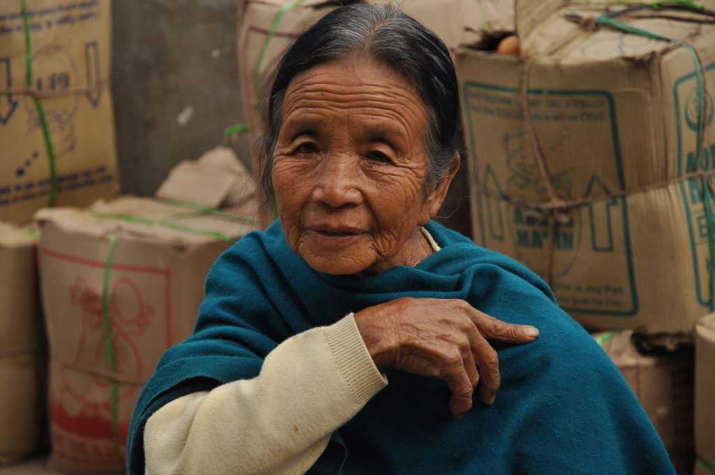
A more welcoming people, very curious, and willing to do a bit of conversation, to “know” those who come from far away to visit these places, where English is “lingua franca” in which most people are able to communicate. This shows the importance given to education, which is evident in Nagaland as well as Magalahya.
Mokokchung
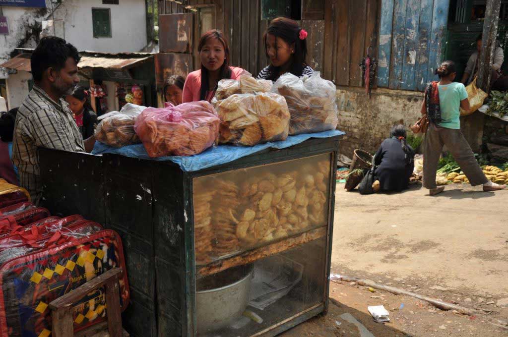
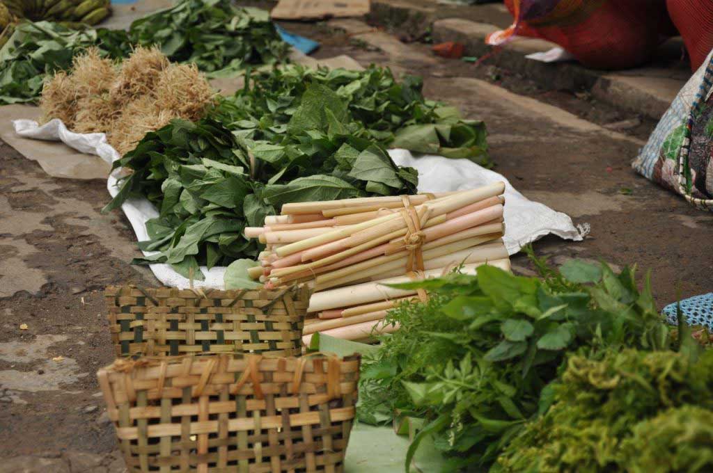
vegetable market at Mokokchung

Mokokchung
Mokokchung

Mokokchung itself arouses little interest. It’s necessary to visit the neighbouring villages to get in touch with the Ao culture. But there is no public transport to these small villages, and the taxi was a too expensive option, that force me to stay in Mokokchung where was little to do, besides rest of intense and long trips. The population in Nagaland, as some of the neighbouring states, is strongly Christian, as a result of the missionary that arrived around the ninth century, so Sunday is scrupulously respected as a day of rest, where all the shops and services are closed. And here “all” means really all, because there is no shop or even a restaurant open throughout the city… no taxis, no buses or sumos, the only thing open are the churches corresponding to the various currents of Christianity.

This made my stay in Mokokchung longer than expected, with the Sunday spent at the hotel, including meals because neither the Hindus of restaurants open on Sundays!!!
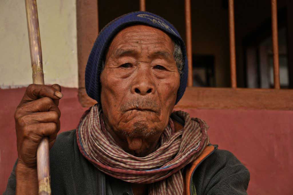
Mokokchung
Mokokchung

Mokokchung
Mokokchung

Where to stay in Mokokchung:

Mokokchung is not yet prepared to guesthouses or other accommodation for backpackers. The signs “hostels” refer to long-term residences for students from other locations, and do not rent rooms.

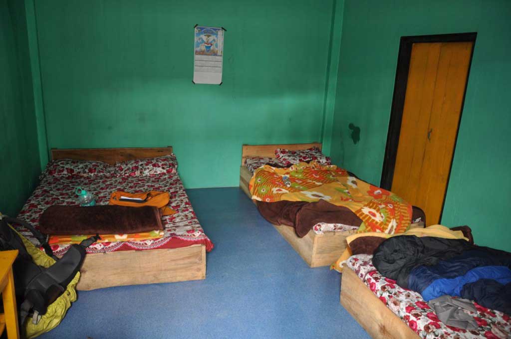
However, two of the city’s hotels have dormitories or rooms with several beds. The dorms are mixed, which may create obstacles to women if there’s already beds occupied by men.

Hotel Metsuben and Whispering Winds are formal hotels, with dwell infrastructure and services but where prices are unsympathetic to backpacker, but where a bed in a dorm costs between 300 to 350 rupees.

  • Whispering Winds: http://www.whisperingwinds.co.in/
Whispering Winds. contacts. Mokokchung
  • Hotel Metsuben: https://www.facebook.com/hotelmetsuben
Hotel Metsuben. contacts. Mokokchung
Hotel Metsuben. rates. Mokokchung

Both are located outside the city center, but within a reasonable distance to be done on foot. The choice was to Whispering Winds, situated on the top one of the hills, opposite the Hotel Metsuben.

Onde comer em Mokokchung:

Where to eat in Mokokchung:

Mokokchung didn’t stand out for food, lying along the I.M. Road several cafes serving parathas, samosas and some snacks. Here you begin to notice some influence of Indian culture, and may even find a lassi or paneer.

In I.M. Road, above the “Friendly’s Restaurant” there’s “The Restaurant” with a pleasant atmosphere serving Indian food (rice and curry) and Asian food (chow mein, noodles, etc…).

Mokokchung
“Bombay Hotel” at I.M. Road, with indian snacks. Mokokchung

Transportes em Mokokchung:

Transport in Mokokchung:

Despite the strong stiffness of the streets, which means always going up and down in a kind of zig-zag, Mokokchung is doable on foot. However, there are buses along the main roads identified as City Ride, which can save you so effort. From the center of the city (near police circle) up near the hotel Whispering Winds it costs 10 rupees.
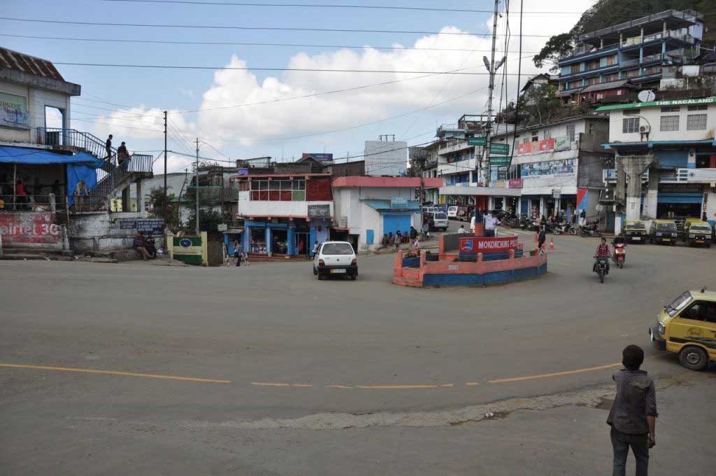
"police circle" o centro da cidade de Mokokchung
“police circle” the center of Mokokchung, nearby is the NTC bus stand, as also a taxi stand

How to get to Mokokchung:

Due to the poor condition of the roads of Nagaland, in part by the lack of investment and maintenance, and partly the winding terrain, there isn’t a road that connects directly to Mon to Mokokchung.

So from Mon is necessary to go to Sonai, in Assam, go through Simaluguri and Amguri, and then get back to Nagaland, through Tuli. From Tuli is 4 more hours of mountain road until Mokokchung.

From Mon there’s a sumo service to Mokokchung, daily (except Sundays), by 6 am. You must book in advance (Travel Link). The sumos have a specific terminal in Mokokchung, near the market, not far from the city center, where is the bus terminal of the NTC (Nagaland Transport Corporation).

  • sumo from Mon to Mokokchung: 650 rupees (8 hours)
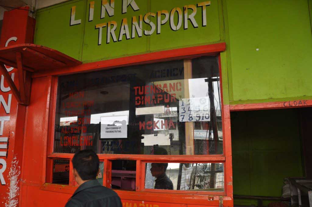
venda de bilhetes para os sumos para Mon. Mokokchung
ticket counter for sumos to Mon. Mokokchung

How to go from Mokokchung to Kohima or Dimapur:

Mokokchung has a great offer in terms of public transport.

In the city center (a police circle) is located the bus terminal of the NTC (Nagaland Transport Corporation), with connections to Guwahati, Dimapur and Kohima.

For other destinations, such as Mon, you must use the sumo, starting from a small terminal near the fresh market.

To Dimapur and Kohima there are many companies offering this service along I.M. Road, near the Police Circle.

  • public bus from Mokokchung to Kohima: 220 rupees

at 6 a.m. part (8 hours)

  • sumo from Mokokchung to Kohima : 430 rupees

6 a.m. and 10 a.m (6 hours)

  • sumo from Mokokchung to Dimapur (night service): departs at 4:30 p.m and arrives near the 5 a.m.
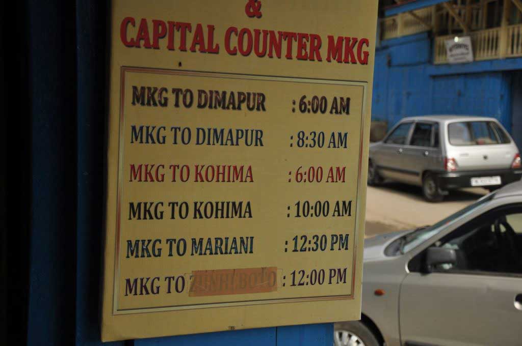
horários dos sumos. Mokokchung

elevation: 1325

population: 35,913
Mon… in the land of the Nagas

Mon greeted me with a violent storm that emerged unexpectedly just after the sunset, after a day when the blue had dominated the sky and nothing could presume this abrupt weather change, that brought also an uncomfortable chill air.

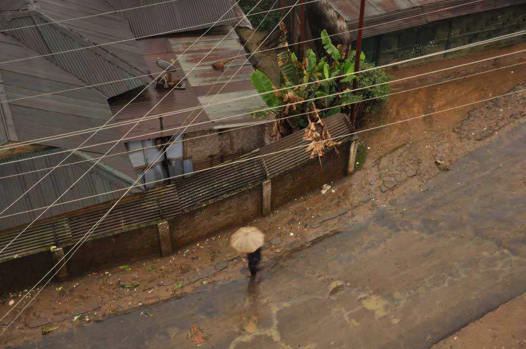
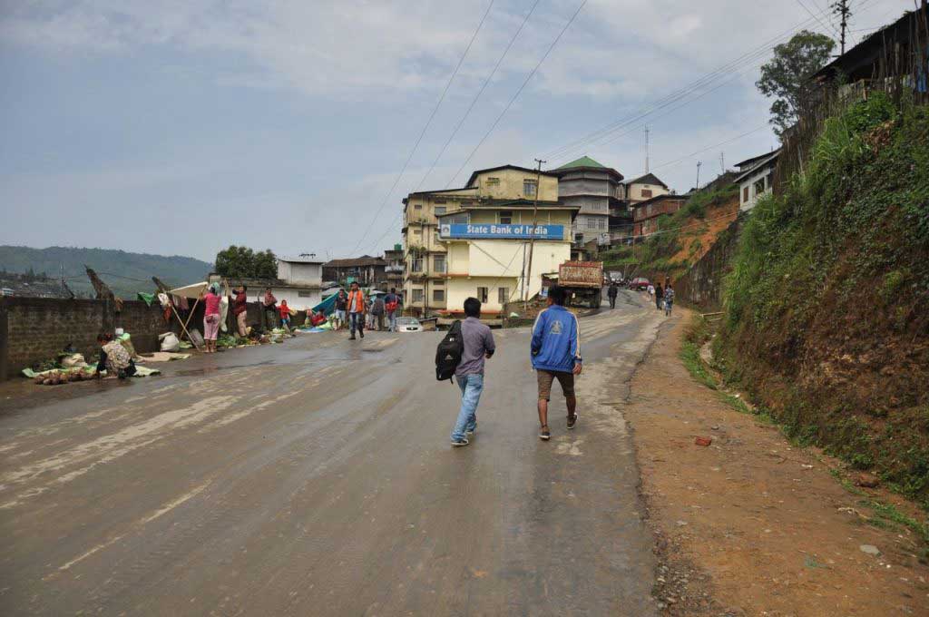
Mon, a small town located on top of hills and spread by its slopes, along winding roads, made of concrete buildings and metal roofs. Mon seems wrapped in a dull and gray mantle, where the scattered light rain creates a sad and depressing atmosphere, making dampen the enthusiasm of any visitor.

Mon Town. Nagaland
Mon Town. Nagaland
Mon Town. Nagaland
Mon Town. Nagaland

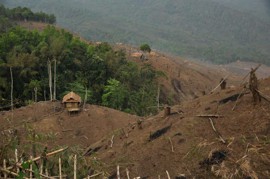
In the mountains that surround the town create an insurmountable barrier on the horizon, where the green dense forest contrast with the urban gloomy scenario. But in some places it’s visible the heaviness of human impact, where large areas of semi-tropical forest have been completely wiped out, exposing the grayish-brown soil that transmits an immense feeling of desolation.

montanhas que rodeiam a cidade de Mon. Nagaland
Mountains around Mon. Nagaland
Montanhas em volta da cidade de Mon, sujeitas a intensa desflorestação que deixam o solo exposto À erosão. Mon. Nagaland
Walking arounf Mon Town. Nagaland

The Nagaland mountains gathering various tribes and ethnic groups, which can count on about 16 and that under the British rule were divided between what is now India and Burma. But these modern borders don’t respect the ethnic and cultural characteristics of these people, which led to conflicts and violent actions, which lasted until 2013. Mon is the center of Konyak tribe, whose territory also extends to the north of Burma, whose physical features and Mongols faces clearly refer us to the Asian people.

The solid mountain range sheltered for centuries these Naga tribes, allowing these people to remain distant from the culture, language and Indian religion, keeping until today their own language, whose writing is curiously in Latin characters. It was also a result of this isolation that they could keep the religious practices, linked to animism, that were only destroyed by the arrival of missionaries, in the nineteen century who brought Christianity to these populations.

But despite this influence, the Konyak, kept alive their traditions, being famous as headhunters, where heads of warriors of enemy tribes were hung in the Morong (communal houses), as trophies after each fight. But from these traditions nothing remains, with human skulls already replaced by skulls of animals in the Morong decoration. But what have not disappeared yet, are the tattoos that men still show on their faces and neck, showing that they were succeeded as headhunters. These tattoos and the pierced ears are decorated with animals horns, are still used by some Konyak men, as well as colored beads necklaces, adorned with bronze carved faces, indicating the number of men killed. But only among the older ones you can find the famous tattoos of these warriors, as the times of tribal fights are getting distant.

Konyak tribe. Mon. Nagaland
Konyak tribe man. Mon. Nagaland

A power cut left Mon Town in the dark during the two days of my stay, and as in the Northeast of India night arrives early, there is not much to do in Mon after 5 pm, pushing me to my room, in a totally empty hotel located on a building abandon during the night, where I was the only human presence. By nine o’clock at night, without electricity and without company, sleep settles softly.

Outside, in a total darkness only interrupted by the glare of the headlights of scarce cars or motorbikes, Mon shows up hostile and sinister.

Mon_Food Market_DSC_8667
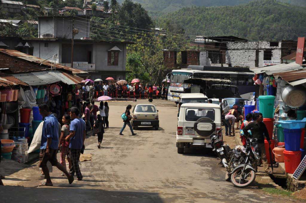
Mon street market. Nagaland
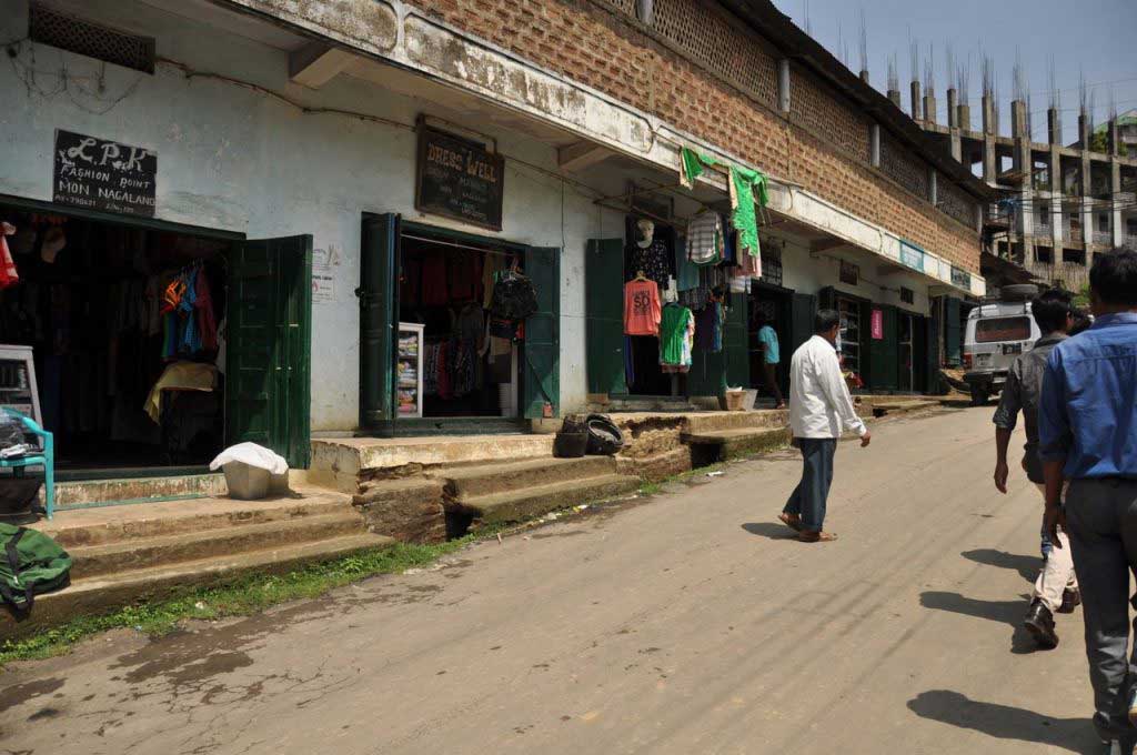
Mon Town. Nagaland
Shopping area at Mon Town. Nagaland

During the day, Mon gains a certain life especially along the streets that gather most of the shops but is still present the feeling of poverty that dominates the city. A poverty not visible in houses or in people, not even in the outfits, were by the way youth wears very westernized and modern clothes, but a poverty associated with underdevelopment that shows up in the appearance of the shops, on the items they sell, in the short supply of products, in scarce diversity of the food at stores or street markets, uninteresting and monotonous food… a kind of poverty that result more from the isolation to which this population is subject, where the only access to Mon has to be done by an unpaved road, where the 65 km takes at least three hours to be covered, and where there are any accessible road connecting Mon other cities of Nagaland state. It is perhaps this isolation and the harsh conditions that make life difficult at Mon, that result in hard and closed faces, from where it is difficult to get a smile.

Mon Town. Nagaland
Mon Town. Nagaland

Where to sleep in Mon:

Pamount Guest House: located above the State Bank of India (also known as SBI), less than 5 minutes from the sumo stand. Double room by 1000 rupees but may be negotiated up to 800 rupees, because the place is empty all year except during the Aoling Festival.

Paramount Guest House contact: 9612170232; 08257811627

The room is small but comfortable and clean, with en-suite and some furniture, but there are several types of rooms with a bigger area. Curiously the six existing rooms on the top floor of this building have an odd numbered 9 to 235, jumping by 170, 210, 75, 215… which later turns out to be the number recorded in each of the keys !!!!

Paramaunt Guest house. Mon. Nagaland

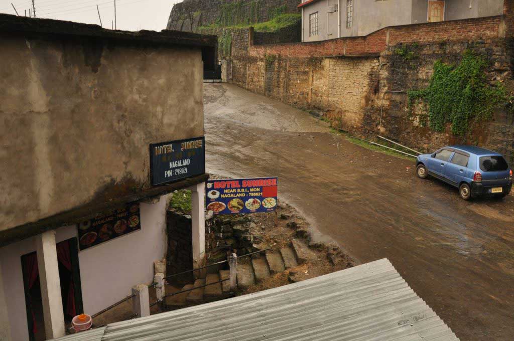
Just on the right side of the State Bank of India building, is the Sunrise Hotel that basically works as a restaurant, but also has rooms to rent. The room are more modest than the Paramount guest house, by 500 rupees, that can be negotiable. The Sunrise Hotel has only two rooms, but any of them with more than two beds; the bathroom is outside the building and has poor conditions.

Sun Rise Hotel. Mon. Nagaland

The Paramount Guest House and the Sunrise Hotel are the only accommodation in central Mon, yet there is Helsa Cottage, which has better rooms for 1500 rupees but is a bit further away.

Where to eat in Mon:

Mon is far from being attractive in terms of food, with a small number of restaurants, all very far from the westernized patterns. During the day, along the main streets, some place serve food but are hardly localizable because there’s no indication, but a curtain covering the door means that is a place with food, basically rice with dal and curry, locally known simply as “rice”.

Being a mountainous area the meat is constantly present but you can always ask for the “rice” in a vegetarian version, making clear no pork and no chicken. However this kind of meal, which gives the right to a “refill” it costs just for 50 rupees, is nutritionally poor and because vegetables are potatoes with a few yellow-peas and the dal (lentil curry) is rather watery.

In terms of street food, Mon doesn’t have much to offer beyond samosas and other fried dough snacks, excessively oily and sold in very poor hygienic conditions.

Basically, you can say that Mon is a disappointment in terms of gastronomy judging by what is available in restaurants and street stalls.

The Paramount Guest House prepares meals by order, that can be served in the room or in the dining room, a rice with dal and curry for 100 rupees, but without the spicy touch.

Next door is the Sun Rise Hotel restaurant serving rice, dal and vegetables, since morning for 40 rupees, but doesn’t serve dinner.

Along the streets of downtown Mon, especially at Market Street, the shopping area, there are several small and discreet eateries that serve puris, samosas or rice with curry. Two puris with a cup of sabji (potato and yellow peas curry) cost 10 rupees.

street food em Mon Town. Nagaland
street food at Mon Town. Nagaland

Transport in Mon:

Mon has a few public bus, but with an uncertain schedule, and is difficult to get information about the destinations. There are private buses, very early in the morning, but just to Dimapur and Kohima. The local means of transport are the sumos and the shared taxis.

  • Hire a taxi to Longwa costs 2500 rupees return. These taxis are stope near the sumo stand.
  • The sumo for Longwa costs 220 rupees (one way) and departure at 6 a.m. or in the afternoon by 1 p.m. It is necessary to book tickets in advance at least one day. The same for the way back. At Mon the tickets for sumo must be booked in a grocery, bit further down from the police circle, on the road that leaves Mon to Sonari.
  • A taxi to Mon Village (about 5 kilometers) costs 800 rupees; no sumo or shared taxis make this trip.

Sundays there is not any kind of transport in Nagaland … there is neither bus nor sumo or taxis.

autocarro publico. Mon Town. Nagaland
Nagaland bus company. Mon Town. Nagaland

How to go to Mon:

And the fastest way to get to Mon is from the neighboring state of Assam, at the city of Sonari. From Sonari sumos run daily, and this arduous journey takes three hours by a dirty road in poor conditions, where most of the journey is in a mountain area.

Being in Nagaland there are only two options to get to Mon: from Dimapur or from Kohima. From these cities run private buses and sumo to Mon, but they always need to pass through Assam and by the city of Sonari, as the roads in Nagaland state are in very bad conditions.

How to go from Mon to Mokokchung:

There’s only one road to get out of Mon, and goes to Sonari, in the neighboring Assam state; so to travel between Mon and any other city of Nagaland, such as Mokokchung, it is always necessary to go through Sonari and Assam roads, are not very good but are flat and paved.

  • sumo from Sonari to Mon: 200 rupees (3 hours)
  • sumo from Mon to Mokokchung: 650 rupees (8 hours)

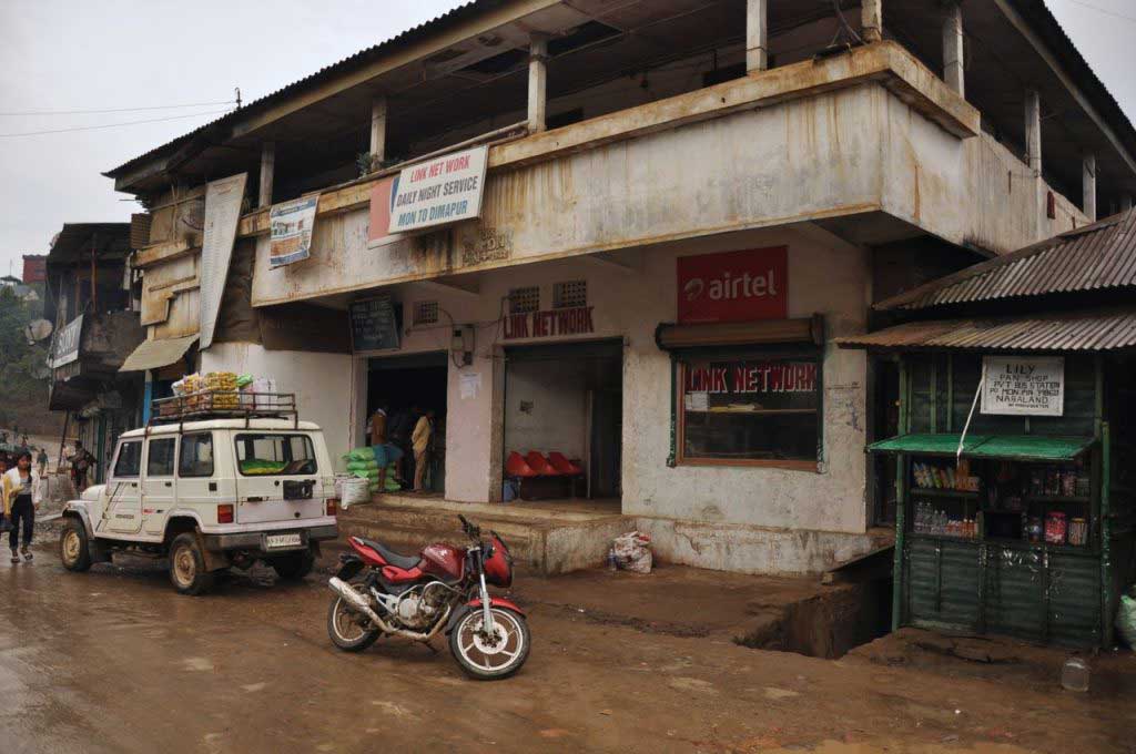
At Mon there’s only one sumo company that run to Mokokchung, the Link Network, with sumos to leave by 6:30 a.m, Monday to Saturday.

For any trip leaving Mon, either to Kohima, Dimapur, Sonari or Mokokchung, is necessary to book tickets at least one day in advance, and soon as possible to be able to choose one of the front seats, as the back seats are narrow extremely uncomfortable for such a long trip. Whatever the destination, the sumo run all early in the morning for 6 am.

empresa que faz a ligação de Mon para Mokochung. Mon. Nagaland
office of “sumo” between Mon and Mokochung. Mon. Nagaland

How to go from Mon to Longwoa:

The 35 kilometers that separate Mon from Longwoa are not easy to do, the means of transport are few; as there are no buses, the trip must be made by sumo or taxi. The sumos run, twice a day: 7 a.m. and 2 p.m. With the shortage of transport is required to reserve the ticket with a minimum of one day in advance.

The journey takes more than 1 hour.

These sumos don’t run from the sumo stand, like the other bound to Kohima, Dimapur, etc… but the road “down” the police circle (roundabout where sometimes is a police officer command the traffic). The sumo park in front of a grocery store, that also sell tickets.

  • sumo: 220 rupees (one way)
  • taxi: 2500 rupees (return)

Mon Festival:

Aoling Festival: annually from 1 to 6 April

During the festival, a show of Konyak culture and traditions, and even a few days before the city of Mon begins to get more visitors, and is almost impossible to find a room, if you didn’t book in advance, and also increase the prices. It is advisable to book in advance if you wish to stay in Mon during the festival.

Internet in Mon:

There is no internet place at Mon; neither Paramount Guest House or Sunrise Hotel have internet or wi-fi.

Right next to the entrance of the State Bank of India, in a corridor with shops, the first shop on the left side, with copies and prints, have internet (when the signal works).

ATM on Mon:

There is only one ATM at Mon, the State Bank of India, where people line up to withdraw money, as the ATM it is not always available or working.

There are frequent power cuts In Mon, affecting the operation of the ATM. So it is recommended to bring enough money for all stay, as there are also no exchange shops.

State Bank of India. Mon Town. Nagaland

elevation: 655 m

population: 16,120

From the Assam plains to Nagaland mountains… from Majuli to Mon

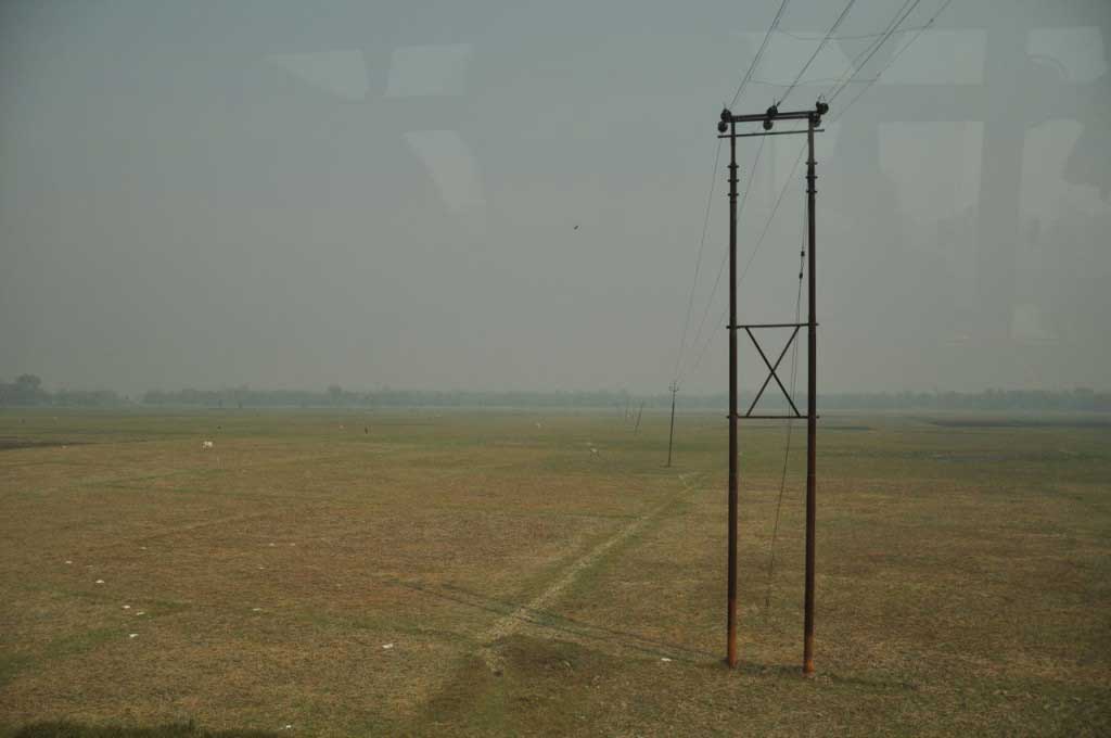
It’s time to say goodbye to the stillness of Majuli and the plains of Assam to heading up the hill to the challenging Nagaland. With the sunrise was time to get out of bed and prepare for departure from the island of Majuli, with the fields still wrapped in a fine mist. The first ferry leaves the island at 7 am, but to get there you have to wait on the roadside for a crowded bus heading to the makeshift pier, that is forced to change location according to the ups and downs of the Brahmaputra river.

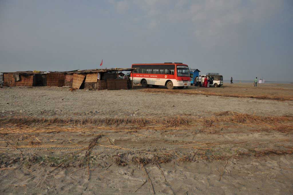
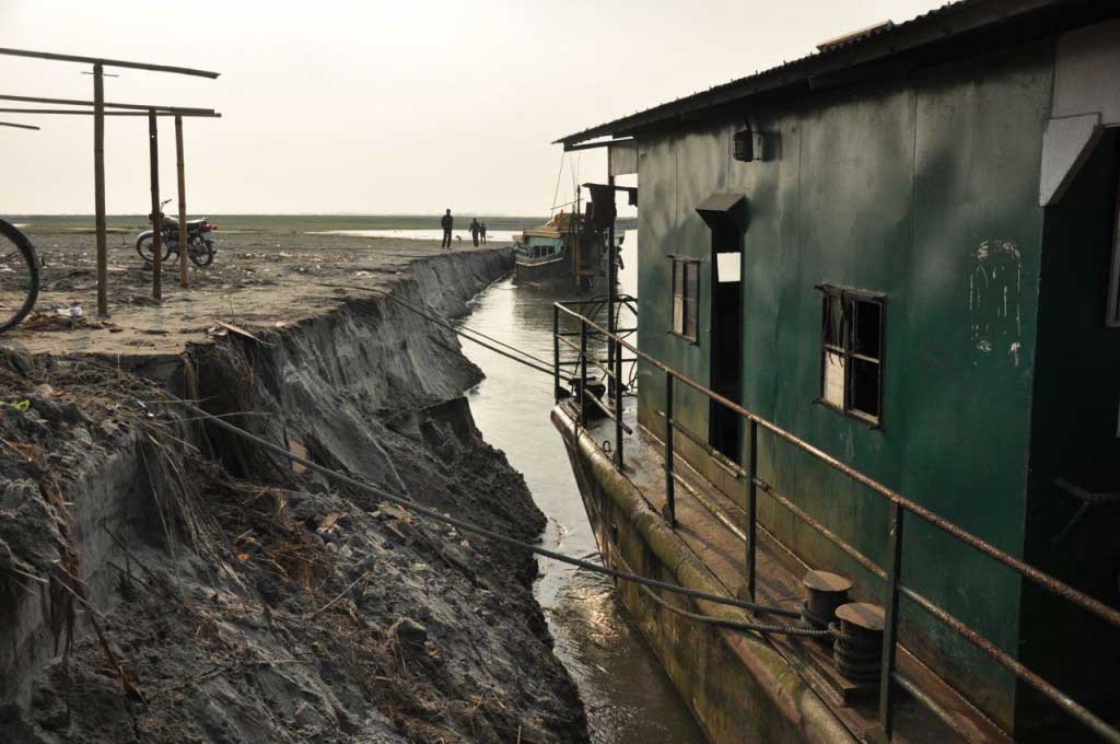
Ferry boat Pier at Majuli Island. Assam

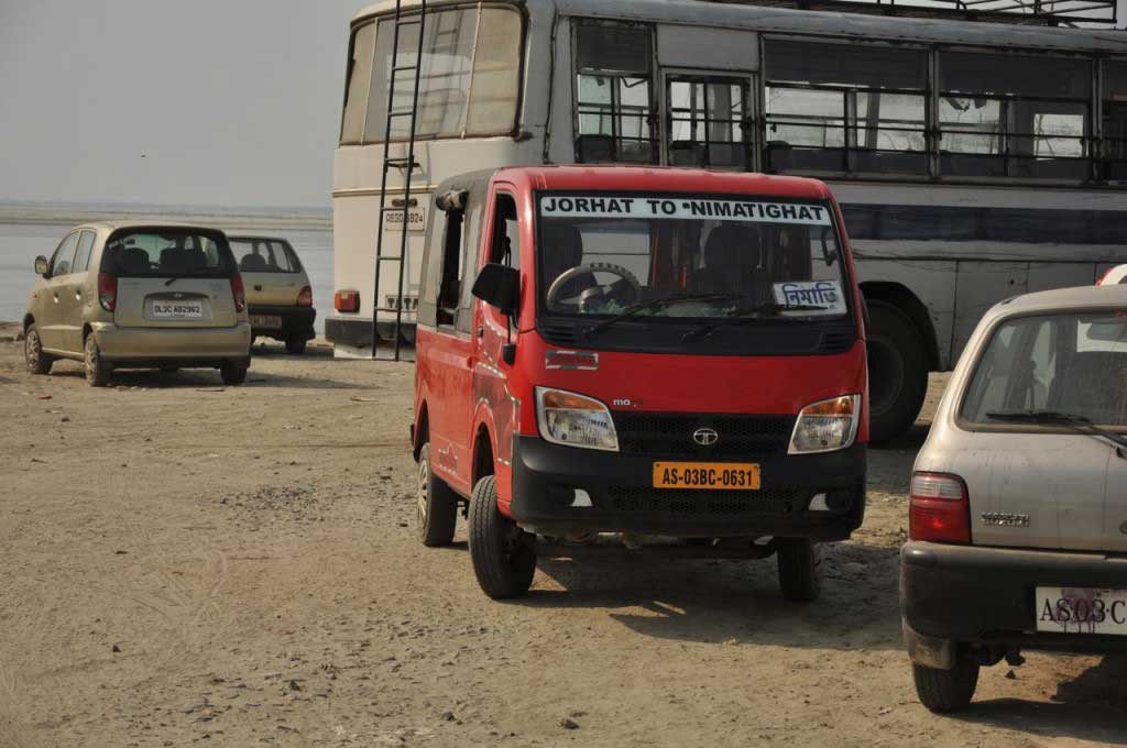
The boat ride is calm and monotonous landscape invites to sleep, but as soon as we landed in Nimati Gaht, this quietness is broken by the tempos drivers, who hurriedly try to put the largest number of passengers in their own vehicle, always in bigger number than space available.

The trip until Jorhat takes no more than half an hour but is uncomfortable enough for us look forward the arrival in the city, where we are “dumped” on a street where taxis and rickshaws line, and where each driver tries to push us to his vehicle. In this situation, when we don’t know where we are and have no idea of the direction to take, the best is to walk a bit, away from this chaos and look for reliable information. So it was time to find same food. But again was impossible to avoid the monotonous paratha with the usual curry of yellow peas and potatoes. To get trustful information in places where the English language isn’t “lingua franca”, the best option is to look for a pharmacy, where usually the owners speak a reasonable English.

With precise guidelines about the direction to take, it was time to start the trip with another series of buses and many transfers… from Jorhart to Sivasagar, from Sivasagar to Sonari, finally from Sonari to Mon.

As not everything follows the logic that we used, not always the buses leave us in the terminals, but somewhere along the road, at the mercy of tuk-tuk and taxi drivers who eagerly wait for disoriented passengers. But as always happen n this kind of long journey, someone shows up willing to help: or giving directions or sharing part of the ride, with the communication resumed to basic words or by using gestures.

Despite the discomfort of the buses, the many transfers, the warm weather, the journey from Majuli flow quit well, with good coordination between different means of transportation and short waits between buses, which encouraged me to go on the same day to Mon, saving me from stay one night in the unattractive and dusty town of Sonari.

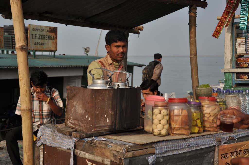
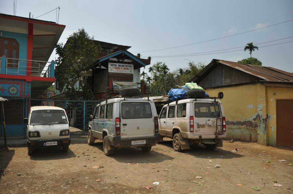
"sumo" stand at Sonari. Assam
“sumo” stand at Sonari. Assam

Nagaland is reputed to be dangerous, especially Mon… perhaps because tribal wars have lasted until recently, perhaps due the proximity of Burma and opium route, or more likely by the isolation and negligence that is voted on this region, where scarce basic infrastructure and were is evident a certain underdevelopment. So often I received warnings not to travel alone in Nagaland, and especially never walk at night on the streets.

With this warnings, it becomes a priority to arrive as soon as possible to Mon, situated in a part of the country where the sun goes down before 5 pm. The only sumo waiting at Sonari was already full and there was no guarantee if there will be more sumos that day. Having glimpsed some space on the back of the Jeep, I could explain why gesture that there was still room for one more. Immediately the friendly driver proceeded to the reorganization of the goods on the top of the Jeep, to get some space near the other passengers, that despite not speaking English received me with smiles.

Nagaland_road Sonari-Mon_DSC_8624
Road from Sonari to Mon. Nagaland

It was easy to know when we leave Assam and entered in Nagaland: Assam is flat… as soon as we start to go up the mountains we know that we are in Nagaland!

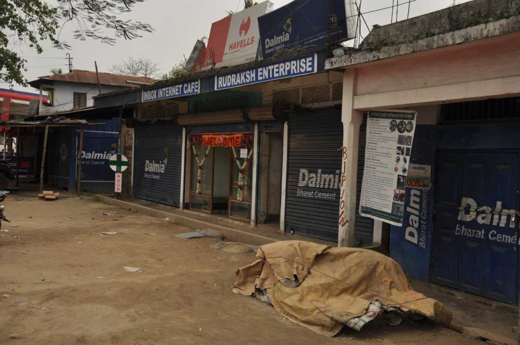
The road that leaves from Sonari, though asphalted is in poor condition, goes flat through tea plantations and warm temperature, into the direction of the mountains. Nagaland begins in the village of Tizit, and from here is always up until Mon, by a dirt road, where trucks and Jeep move slowly, overcoming bumps, avoiding pits and crossing small water stream. Is a road opened on the mountain slopes, with scattered villages, but where the impact of human presence is evident, by intense deforestation that leaves the poor top soil exposed to erosion, stolen life to this green forest, that is replaced by a brown color.

As we get closer to Burmese border, it is clear that we get in a sensitive area of the Indian territory, by the proximity to the opium route and by the ethnic and tribal conflicts that have kept this area in a war until 10 years ago. Along the way we are stopped by several checkpoints, by police and the army, and even by civilians who make rough inspections of vehicles, goods and passenger documentation, with foreigners being controlled with more bureaucracy.

One of the checkpoints along the road from Sonari to Mon. Nagaland

The arrival at Mon was a bit grim, mainly because of the warnings about being a “dangerous” area, that never revealed or specified the risks, but that left a shadow of concern in the air.

The optimism and enthusiasm that characterized this journey from the plains of Majuli island, faltered on arrival Mon… maybe due to the tiredness, maybe because of the dark sky… but probably as a result of the heavy energy of the place. But the arriving of the night and the rainy weather didn’t allow to see more than a cluster of houses, spread along the hills, where the gray tone of the sky blends with the rusty metal roofs.

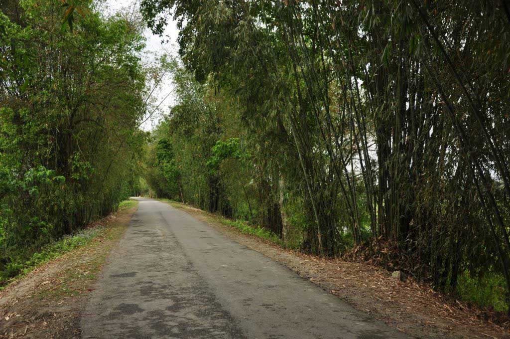
Paisagem a caminho de Mon. Nagaland
Landscape on the way to Mon. Nagaland

Permits:

It is not necessary any permit for entering and traveling in the state of Nagaland.

But you must give a copy of the passport in the check-point in Tizit. If you don’t a copy, you find a shop across the street that can make one for 5 rupees.

How to go from Majuli to Mon:

Is a long and demanding journey, but with luck it’s possible to be done in a single day, saving a night on the uninteresting town of Sonari. But if necessary Sonari has accommodation. Another alternative is to stay in Sivasagar one day, taking the opportunity to visit the famous temples, and start the second stage of the journey on the next day.

  • The journey begins at 6.30 am in the morning to catch the first ferry out of Majuli at 7 am.
  • As you arrive at Nimati Gaht take a tempo (small shared taxis that carry more than 8 squeezed passengers) from the pier to Jorhat. All tempos end their journey on the main road at Jorhat, next to a petrol station. In front of the petrol station, there are tempos and tuk-tuk (also shared) following to the Jorhat Bus Terminal, located at the entrance of the city, close to the highway.
  • At the bus terminal is necessary to look for buses to Sonari, or in an alternative to Sivasagar. Outside the terminal, also stop private buses, bound for Dibrugarh, passing through Sivasagar. This was the option avoid the long wait for the ASTC (public company) buses, but these private companies have the disadvantage of stopping at much more time to collect passengers… but still are faster.
  • At Sivasagar is needed to take another bus to Sonari, from the Bus Terminal. As these two cities are close, there are regular services is this connection works as a local bus. You can buy the ticket inside the vehicle, but it doesn’t ensure a seat.
  • At Sonari, the bus stops at the main street, and you need to take a tempo to the sumo stand to Mon. It’s located on a side street, parallel to the main road. There is no indication or schedule of sumos… the later it gets smaller the chance to find a sumo for Mon. If necessary, in this place there are basic accommodation and you can make a meal based on rice and curry (50 INR) while waiting.
  • The sumo trip to Mon is long and uncomfortable, with the first part along a ruined pavement road, along a flat area. After crossing the border with the state of Nagaland, marked by a police/army checkpoint at Tizit, the conditions get worst, becoming a dirty road, in very poor condition, going up the mountain. Along the way, the sumo stops several times to drop goods and passengers, but there is no village around. Only halfway we find a small group of stalls selling fruit and vegetables and where you can buy water.
  • The travel from Sonari to Mon takes about 3 hours depending on the number of stops, obstacles on the road, and the various checkpoints where sometimes the passengers must get out.
  • The arrival Mon is almost by the end of the day but before 5 pm.
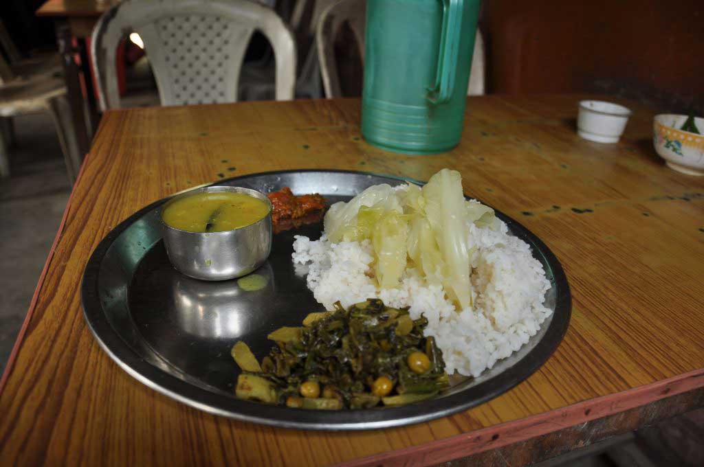
food at the "sumo" stand at Sonari, before start the trip to Mon. Assam
“not that bad” food at the “sumo” stand at Sonari, before start the trip to Mon. Assam

Summary:

Bus until Kamalabari Ghat: 15 rupees (15 minutes)

Ferry from Kamalabari Ghat (Majuli) to Nimati Gaht: 20 rupees (1.15 h)

tempo from Nimati Gaht to Jorhat: 30 rupees (30 minutes)

tempo from Jorhat (petrol station) to the Bus terminal: 10 rupees (10 minutes)

bus from Jorhat to Shivasagar: 50 rupees (2 hours)

tempo from Shivasagar to the bus stand: 20 rupees (5 minutes)

Bus de Shivasagar for Sonali: 30 rupees (2 hours)

tempo de Sonari to the stand sumo (to Mon): 10 rupees (10 minutes)

sumo de Sonali to Mon: 200 rupees (3 hours)… for just 65 km!!!!

Majuli and the “satras”

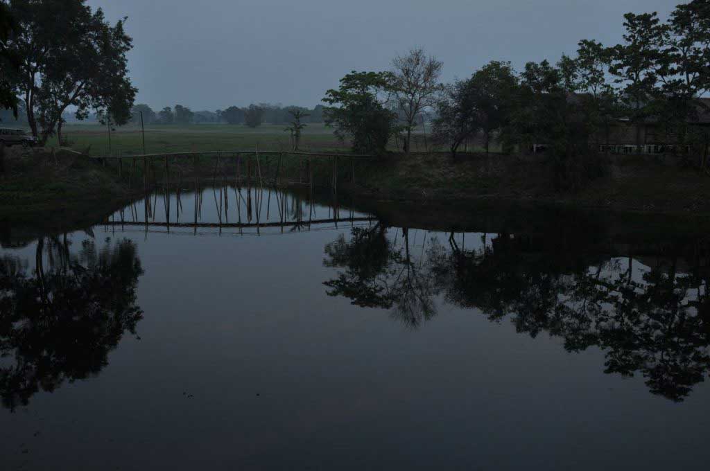
From Majuli Island remain a quiet memory of the days spent quietly at the pace of bike tours, by roads surrounded by bamboos, that gently cut through the rice fields, whose green color fades under the gray sky, whose thick layer of clouds, brings a promise of rain.

Majuli Island. Assam

Feels the presence of a mysterious silence, only interrupted by the rhythmic chirping of unseen birds, hidden in the dense canopy of trees. Egrets and storks search the muddy bottom of ponds left by the monsoon, while small birds pick insects along the roadside, in a hurried pace.

The flat landscape out of sight, with the skyline blurring in the fog that comes up from the fields, constantly soaked in water. In this diffuse scenario joins the smoke that slowly comes from bonfires made to burn the waste from the previous harvest, preparing the fields for another rice crop, in an island where agriculture is the main activity of the population that don’t exceed 150 thousand people.

Majuli Island. Assam

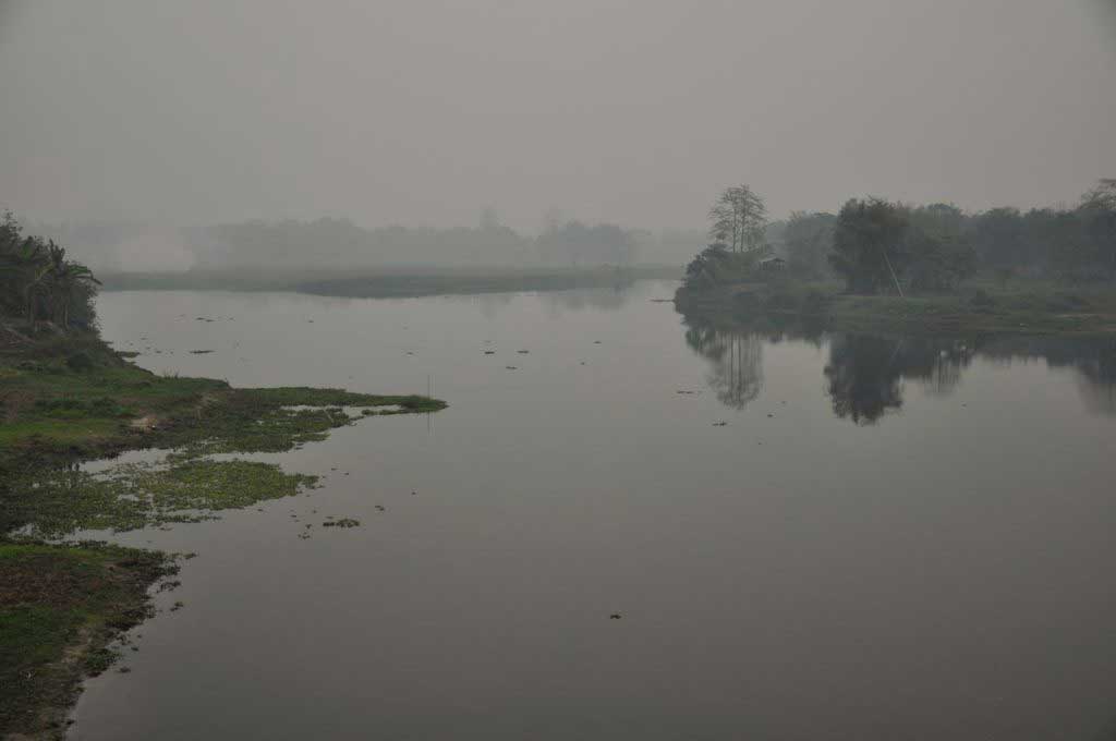
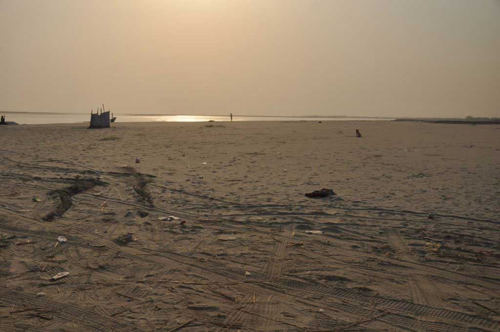
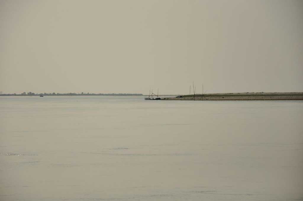
The Brahmaputra, the mythical and muddy river, which the apparently gentle waters become violent during the monsoon period, pouring the bed river and causing serious flooding. It’s this powerful force that is causing an accelerated erosion of the banks of Majuli island, which annually sees your area be reduced, with some villages been already swept away by the water. According to analytical predictions, the Brahmaputra can heal the entire island in 20 years… but nature has hidden plans, and what we see now as an island result from a huge flood in 1750.

Majuli Island. Assam

Despite being scattered all over the Assam state, Majuli shows the highest concentration of Satras, that attracts most of the visitors and helps to make this flat and green land, in a special place.

The Satras are like monasteries dedicated to Hinduism, created in the sixteenth century by the king of Assam, and despite changes and reforms have been working since then keeps as a center of arts and culture, in addition to the religious proposes. But religious practices in these monasteries differ from Hinduism practiced in the rest India, having diverged and gain own forms by the hand of Srimanta Sankardeva, who professed a monotheistic form of Hinduism called Vaishnavism. Depositaries of sacred scriptures of Vaishnavism, whose saint Sankardeva found refuge in Majuli, the Satras are still a place of pilgrimage among Assamese.

Majuli Island_DSC_8558
Majuli Island. Assam

There are hundreds of these monasteries around the state of Assam, 65 of which concentrated in the 1250 km2 of the Majuli Island, but where only 26 are still in running.

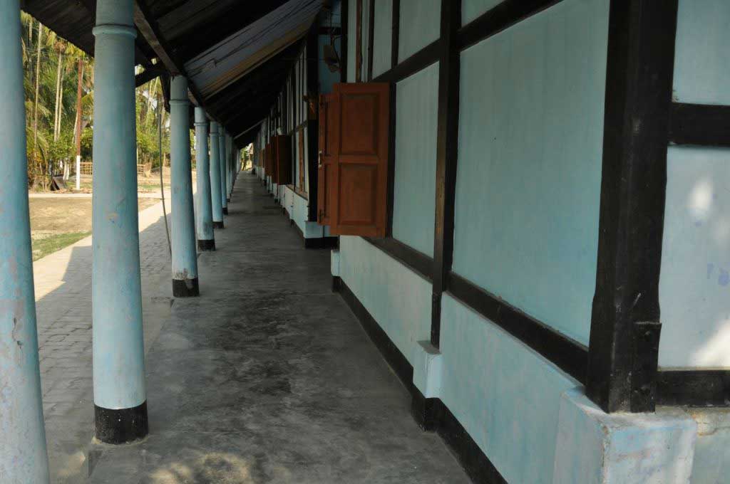
Differing in importance, age and size, all Satras basically follow the same structure, occupying a large area, which access is symbolically identified by a gate, that is decorated with lions, elephants, fish, horses, where some of these animals are depicted with wings or details that transport us to an unknown mythology. In the center of the Satra is a large pavilion reserved for rehearsal and performance of music and dance shows. Inside there’s always a giant wooden statue of Garuda, a winged figure with a long nose, a mix of man and bird, which back to the entrance, protects the place. Attached to this communal area there’s the altar, whose best example is the Sri Sri Auniati Satra, richly decorated. Around, forming a rectangle, are arranged the dormitories and other facilities, lined up under the ground floor galleries.

From the visited satras, the Uttar Kamalabari, located very close to the village with the same name, is the most attractive ad well maintained, keeping its old structure and the traditional construction, which gives an atmosphere able to transport us in time.

Bengenaati and Garamur are two other Satras easily accessible by bicycle, and worth being visited with time, to enjoy the peace and tranquility of the place. But they are also a good excuse to explore the island and observe the daily life of the population, enjoying the changes of light, that is able to make the monotony of the flat landscape in a surprising and mysterious scenery.

Garuda. Sri Sri Auniati Satra. Majuli. Assam

Night falls early in Majuli, as we are to the east of which is the central India, so just after four o’clock the sky begins to darken, with night arriving around 5 p.m. This makes it seem like the days are too short, especially for those that are not used to get up early. But here the population starts early daily routines, to work in the fields to rule the daily life in Majuli.

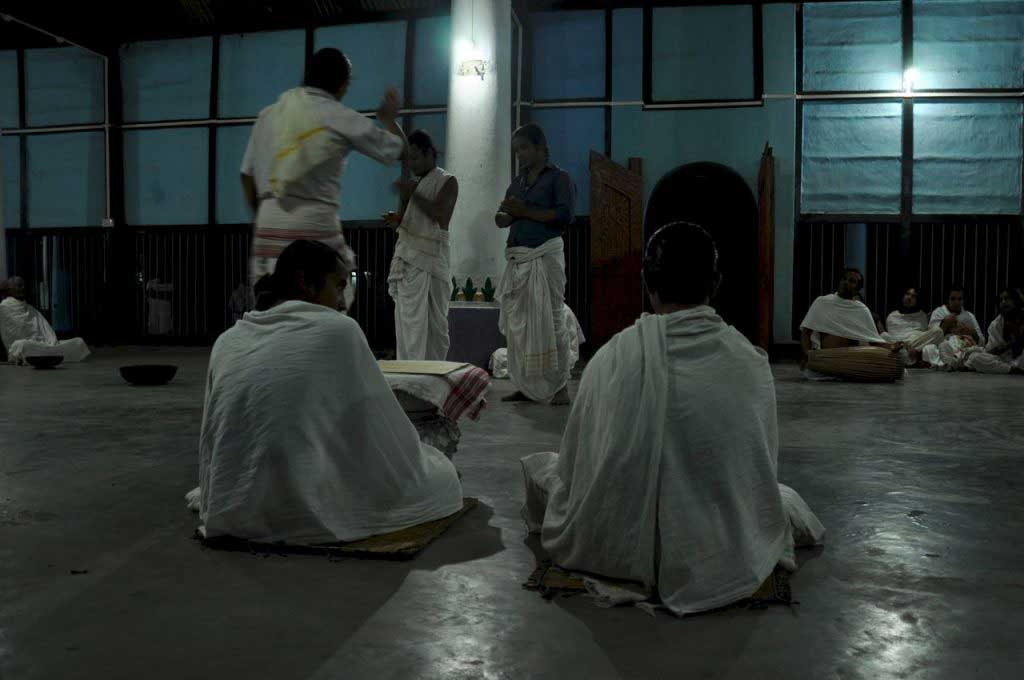
And it’s with the evening that something magical seems to happen in the satras that show almost deserted during the day. Under the dim yellow light, boys and young adults meet in the common area of Uttar Kamalabari, dancing and acting, to the sound of drums and soft melodies, where the mudras (symbolic or ritual gesture) are fundamental. Around, sitting on mats, Bhakats (celibate monks) observe closely the movements of these apprentices, correcting and encouraging. Sometimes these older monks have an active role in the rehearsals, playing mythic characters of hindu pantheon. The satras, besides the religious aspect, also work as art centers, where dance, theater, singing and music are fundamental pillars of the spread of Vaishnavism.

Satra Uttar Kamalabari. Majuli. Assam

Satras:

Of the dozens of Satras existing in Majuli, these are easily accessible by bicycle. For the others, is necessary to hire a taxi as there are no motorbikes for hire.

Bengenaati: the oldest satra

Garamur: large and well-preserved satra

Sri Sri Auniati Satra: the most richly decorated

Uttar Kamalabari: the one that best preserves the original architectural features and which has more atmosphere.

There is a museum at Sri Sri Auniati Satra (50 rupees) but has no great interest, with some artifacts in poor condition, and with poor information. Some of the other Satras also have a museum, usually closed, and it is necessary to find out who has the keys and willingness to open the space to visitors.

Satra Uttar Kamalabari. Majuli. Assam
Sri Sri Auniati Satra. Majuli. Assam
Garuda. Sri Sri Auniati Satra. Majuli. Assam
Sri Sri Auniati Satra. Majuli. Assam
Satra Uttar Kamalabari. Majuli. Assam

Weaving at Majuli island:

Although the biggest attraction of Majuli are the Satras, a longer visit allows seeing the modest but elaborate weaving, made by women.

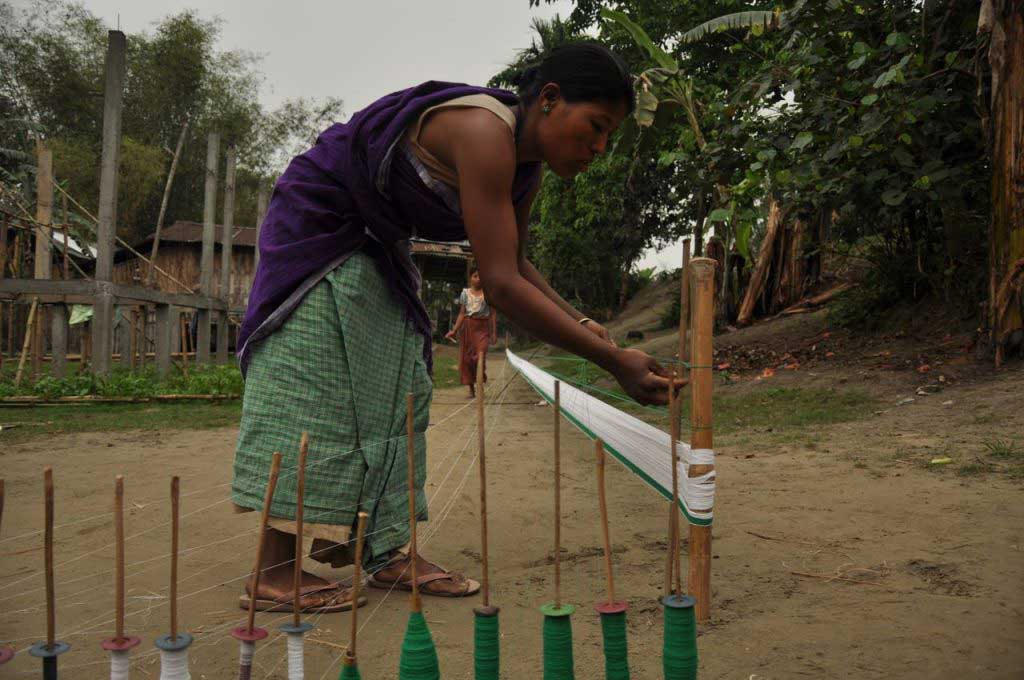
In precarious huts, under the bamboo houses, in the yards, at the porches… women, from different generations, spend hours weaving elaborate textiles in simple wooden looms, which result in colorful and intricate patterns.

One would think that this is an important economic activity that keeps women occupied while the rice fields don’t need so much manpower. But these beautiful weaving fabrics are to be used be themselves, with the simple ones as casual outfit, and the most elaborate and showy for special occasions, such as visiting a satra, which is always done in a family.

The Assamese, particularly men often wear a cloth around the neck, in the form of a scarf, the gamosa where over a white background arise in a bright red color, figures or geometric patterns, that stand out in the plain background. These scarfs, that can easily be mistaken with towels, have several uses and serve not only as an adornment around the neck or around the waist, as well as a bath towel, or for decorating tables and altars. The red and white of these fabrics is a common ornament of satras statues, as well as an essential decoration of the garuda, with a long nose and broad wings.

Majuli Island. Assam

Where to stay in Majuli:

In Kamalabari there are several guest houses within a walking distance, with a backpack. But some of them refuse to receive foreign, saying that are full. Others offer poor conditions. In general, the accommodation in the island, as well as in major cities of the northeast states, is more expensive than usual, with a double bedroom with shared toilet, costing at least 400 rupees.

From several places visited in Kamalabari and Garamur, the best option is undoubtedly the Ygdrasill Bamboo Cottage, located near the road that connects the two villages. You can rent a bike (50 rupees) and order meals. The delicious dinner is composed of varied and yummy dishes; costs 150 ruppes… but the food is adjust to Western “taste”, ie without spicy.

There are several types of rooms at Ygdrasill Bamboo Cottage, all built in wood and bamboo. A double room with en-suite can vary between 600 and 1000 INR.

Ygdrasill Bamboo Cottage (on the road between Kamalabari and Garamur)

Contact: bedamajuli@gmail.com

Tel: 08876707326; 088 222 42244

In parallel with this hotel business, and based on the same site, there is a NGO – Amar Majuli – dedicated to supporting local development projects, particularly women.

https://www.facebook.com/pages/Amar-Majuli/706510102708825

Contact: amarmajuliproject@gmail.com

Ygdrasill Bamboo Cottage. Majuli Island. Assam

Where to eat in Majuli:

In Ygdrasill Bamboo Cottage is served dinner to the guest, and it worth, because the options in terms of restaurants, both in Kamalabari as Garamur, are truly poor and unattractive.

For breakfast you can find samosa or puris (fried flat bread) accompanied by a boring potato curry, in several restaurants. At lunch it’s only served one dish, the usual rice and potato curry and a few scarce vegetables, accompanied by a watery dal (lentil curry).

However the most popular dish is paratha, which here is made plain, without stuffing, which is no more than a flat bread, cooked in a frying pan with a bit of oil. To accompany this kind of pancake is served a potato curry, where some grains and a sweet chutney, that more resembles a fruit jam.

Clearly Assam is not a destination for those food is one of the attractions of travel!!!… potatos at every meal! However the food is very cheap, with a samosa costing 5 rupees, a meal of paratha about 25 rupees and a rice-based meal costing 60 rupees.

Transport in Majuli:

There are shared-taxis from Kamalabari to Garamur, locally called tempo, or sumo it’s a Jeep, which connect the main towns to the Kamalabari Gaht, from where the ferry. So it is best to walk down the road and wait to pass any of these vehicles or one of the few buses that connect to the ferryboat.

  • bus from Garamur for Kamalabari Gaht: 15 rupees
  • tempo or sumo (shared taxis) of Garamur to Kamalabari: 10 rupees
  • taxi from Garamur to Kamalabari Gaht: 200 rupees

Another option is hitchhiking, to some passing cars, not being yet difficult to get a ride because of the generosity of people.

But the best is to rent a bike. The roads are flat but have some areas in poor condition. There is no shop specializing in this business, so it is necessary to go asked the local population. Some of the guest houses rent bicycles.

Raja is a friendly taxi driver who was very helpful in the search for accommodation, at a time when almost everything was full because of the visit of Prime Minister to the island. Contact: 8811 9777 51

Internet in Majuli:

As is normal in the accommodation in Assam and other northeastern states of India, there is no wi-fi. It is necessary to look for an internet post: “web-cafe” or “cyber-cafe”. However there is not always wi-fi, but only computers.

But Kamalabari has an internet point with wi-fi and good connection and reasonable speed, situated between the main junction and the gasoline pump.

  • Wi-fi: 20 rupees per hour.
wi-fi cyber cafe. Kamalabari. Majuli Island. Assam

elevation: 84 m

population: 153,400

… from paradise to paradise, going through hell… from Nongriat to Majuli

Purpose: leave Nongriat and the fantastic scenery of Khasi Hills in the state of Meghalaya and go to Majuli, a river island situated in the mythical Brahmaputra, that run through Assam plains.

Obstacles: First it was necessary to overcome about 3000 steps that separate Nongriat from Tyrna, and there find a public transport to Sohra. Then go from Sohra to Shillong, and from Shillong to Guwahati. And from Guwahati reach Jorhart before the last ferry leave to Majuli Island.

Mode of transport: sumo (shared-taxi), tuk–tuk, tempo (shared tuk-tuk), bus and ferryboat.

Team: three intrepid travelers of different nationalities, with extensive experience traveling through India.

***

Looking at the map, knowing a little about how to travel in India, and being already familiar with the transport system in the Northeast states, this trip, although ambitious had no major problems, apart from the fact that it will take two days to win the nearly 470 kilometers that separate Nongriat from Majuli. To all this joins the need to spend a night in the city of Guwahati, whose hospitality wasn’t a good memory from the last visit.

But the Northeast States have their peculiarities that have created unexpected obstacles, requiring much patience and effort. First, it was the Holi Festival, celebrated by Hindus in Assam, and being a holiday just before the weekend allows many people to travel, making difficult to find public transports. By chance or not, this weekend coincided with Easter, and being Meghalaya a strongly Christian state, it was guaranteed that no public transport run from Good Friday to Easter Sunday. With this scenario, we could end “stuck” in the uninteresting village of Sohra for a few days. Adding to all these, the Assam regional elections, that put the quiet island of Majuli in the itinerary of the election campaign of the Indian prime minister, which brought with it thousands of people, in a kind of pilgrimage.

Climbing the steps from Nongriat to Sohra left legs tired, the body soaked in sweat, and some melancholy for abandoning such paradisiac place.

But the bucolic calm of the countryside was quickly replaced by the rush and stress to leave quickly Sohra and reach Shillong in time to take a “sumo” to Guwahati, in a period that the weekend and the Holi Festival had put lots of people traveling, decreased the chances of getting a places in the sumo which link the capitals of Meghalaya and Assam states. But this mission was done with success, despite the long wait near unfriendly and drunken staff of sumo company, who took advantage of the situation charging a few extra rupees for the ticket.

On arrival at Guwahati was repeated the frustrating search for accommodation, in a city where many of the hotels and guesthouses don’t allow foreigners, pushing us too costly options. After a dose of antipathy, just the unattractive dorm of the Youth Hostel remains, which in these situation proved to be quite friendly, and where the decay of the place gained a touch of “patina“.

Despite the comforting meal and a deep night of sleep, the group was demoralized by the idea of 6 hours bus ride to Jorhat. But waiting for us, was a modern luxury bus, from the recommended state company, ASTC, with comfortable and spacious seats, giving encouragement for the next step of this journey.

Campos de arroz. Assam
Rice fields along the road from Guwahati to Jorhart. Assam


Plantações de chá. Assam
Tea plantations along the road from Guwahati to Jorhart. Assam

As the flat and monotonous landscape of Assam, of rice fields and tea plantations passing through the windows, the eyes were getting heavy and the body surrender to sleepy inertia. But nothing lasts, and we were suddenly forced to abandoning the comfort of air-conditioning, dumped to the dusty and noisy edge of the national highway, without knowing exactly where we were. So this way we arrive to Jorhat!

At Jorhat, there was no time to stops, and from tuk–tuk to tempo, in the middle of the disorganized city traffic, we made the turbulent journey through a dusty bumpy road, until Nimati Gaht. After this last tempo ride, squeezed between other passengers and luggage, arriving to the muddy banks of Brahmaputra, in time for the last boat, was a relief.

Nimati Gaht, Jorhart. Assam


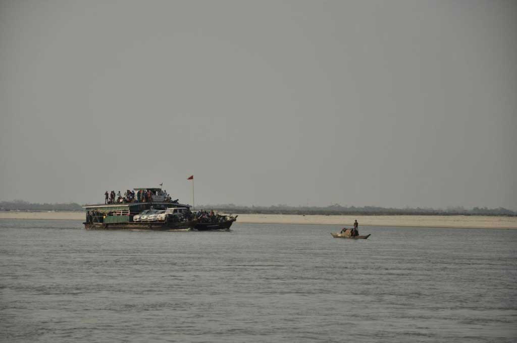
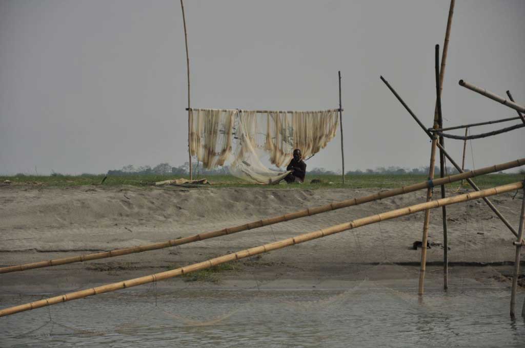
From Nimati Gaht (also written as Neamati), a makeshift ferry pier where the stormy river doesn’t allow lasting structures, followed a quiet trip to Majuli, in a crowded ferry boat, where the roof of the passenger compartment, is used to transport goods and motorbikes… and a few more passengers. The trip on the boat’s roof, besides the fresh air provides a view to the island, whose completely flat surface blends with the horizon.

Brahmaputra. Assam
Brahmaputra. Assam


Brahmaputra. Assam
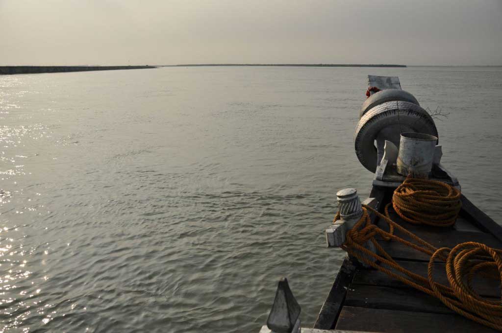
Ferry boat that cross the Brahmaputra until Majuli. Assam


Brahmaputra. Assam
Brahmaputra. Assam


Brahmaputra. Assam
Brahmaputra. Assam


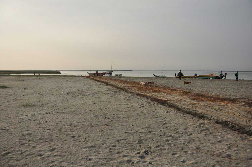
As we left the ferry directly to the sand bank that forms Majuli (officially the world’s largest river island), we were hastily conducted to an already full shared-taxi. Soon all the vehicles were full and quickly leave the pier area. Luckily a military bus gave us some space and a pleasant talk. After the journey through the sands, follows a green and rural landscape, where the road takes us to the first village: Kamalabari.

Assam_Brahmaputra River_Ferry_Majuli_DSC_8592
Kamalabari Gaht. Majuli Island. Assam


Majuli junto ao local onde os ferry boats atracam. Assam
Kamalabari Gaht. Majuli Island. Assam


And when finally, after almost two days on the road, we finally arrive at our destination, the biggest obstacle of all trip emerged: finding accommodation in Majuli.

The options are not many on the island, but to aggravate the situation, our arrival coincided with the visit of Indian Prime Minister to the island, during the campaign of regional Assam elections. In India, political campaigns mobilize many people, but this time, the situation has worst due to the presence of Modi, on which lies a sort of almost religious veneration, attracting an unusual crowd to the island. As it was the first time a prime minister visited Majuli since India’s independence, lots of people come to the island to see him, reducing the chances of find accommodation.

With the help of some locals, vegetable vendors, taxi drivers and even from the troops, that were there to ensure the security of the Prime Minister, it was possible after 3 hours of searching to find a place to sleep, where the owner took advantage of the situation, inflating the price of the rooms.

Despite being a bit unpleasant, the room offered conditions for a well-deserved rest after a terrible meal, of dal and potato curry, an oily paratha and a stew of yellow pea and more potato. This boring yellowish meal marks the beginning of a series of meals, which force me to correct my quote “that the Indian food even if not good, is never bad!”… as the stay in Assam made me change my mind!!!


How to go from Nongriat to Guwahati:

  • climbing almost 3000 steps until reaching the main road;
  • walk to Tyrna, for about half-hour; from here you can also take a taxi directly to Sohra;
  • Bus or shared-taxi from Tyrna to Sohra: 40 rupees (20 minutes)
  • “sumo” from Sohra to Shilllong: 70 rupees (1.5 hours)
  • Shilllong in the sumo ends in Babra Bazaar, within a terminal on the top floor. To find the sumo to Guwahati is necessary to go to a bigger terminal in another concrete building about 5 minutes further up, in the same street, on the left side. If there any available sumos here, you need to catch a taxi (or walk) to Police Bazaar, and then down the Keating Road (left of GS Road) until you find the sumo stand to Guwahati, the left side.
  • sumo from Shilllong to Guwahati: 170 rupees (2.50 hours but can be more than 3 hours depending on the traffic).
  • In Guwahati, the sumo ends at Paltan Bazaar, near the bus terminal and the train station.


"tempos" uma espécide de taxi partilhado entre Jorhart e o Nimati Gaht. Assam
“tempos” a kind of shared-taxi that link Jorhat to Nimati Gaht. Assam

How to go from Guwahati to Majuli:

  • Bus from Guwahati to Jorhat: 330 rupees (the trip takes seven hours, stopping for breakfast). The bus leaves the passengers outside the city, on the highway. From here to the Bus Terminal of Jorhat, is not that far and can be done on foot.
  • Shared-taxi (tempo) from here to the center of Jorhat (Jorhart bazaar): 20 rupees (10 minutes)
  • In Jorhat (bazaar) there are shared-taxis (tempo) to Nimati Gaht: 20 rupees (20 minutes)
  • Ferry Nimati Gaht to Majuli Island: 30 rupees (1 hour)
  • Shared-taxi from the pier to Kamalabari (the nearest village): 30 rupees (20 minutes)


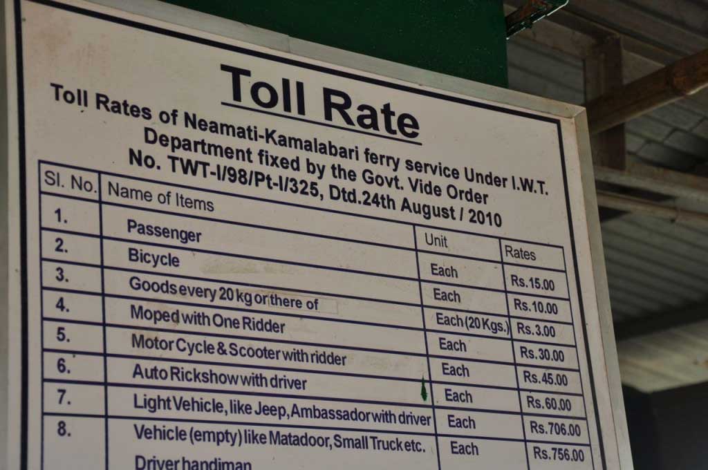
Tarifas do ferryboat para Majuli. Assam
Ferry boat fees… despite the 15 rupees written on the boars the ticket is 20 rupees. Majuli Island. Assam


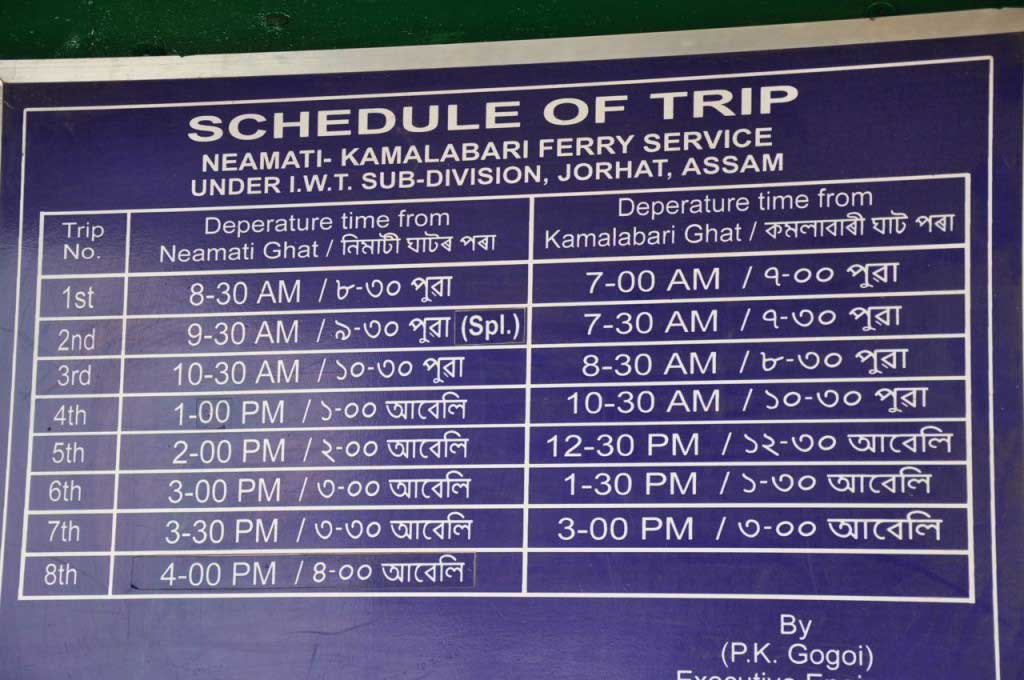
Horário do ferryboat para Majuli. Assam
Ferryboat Schedule. Assam


Living Root Bridges… between mosses and fairies!

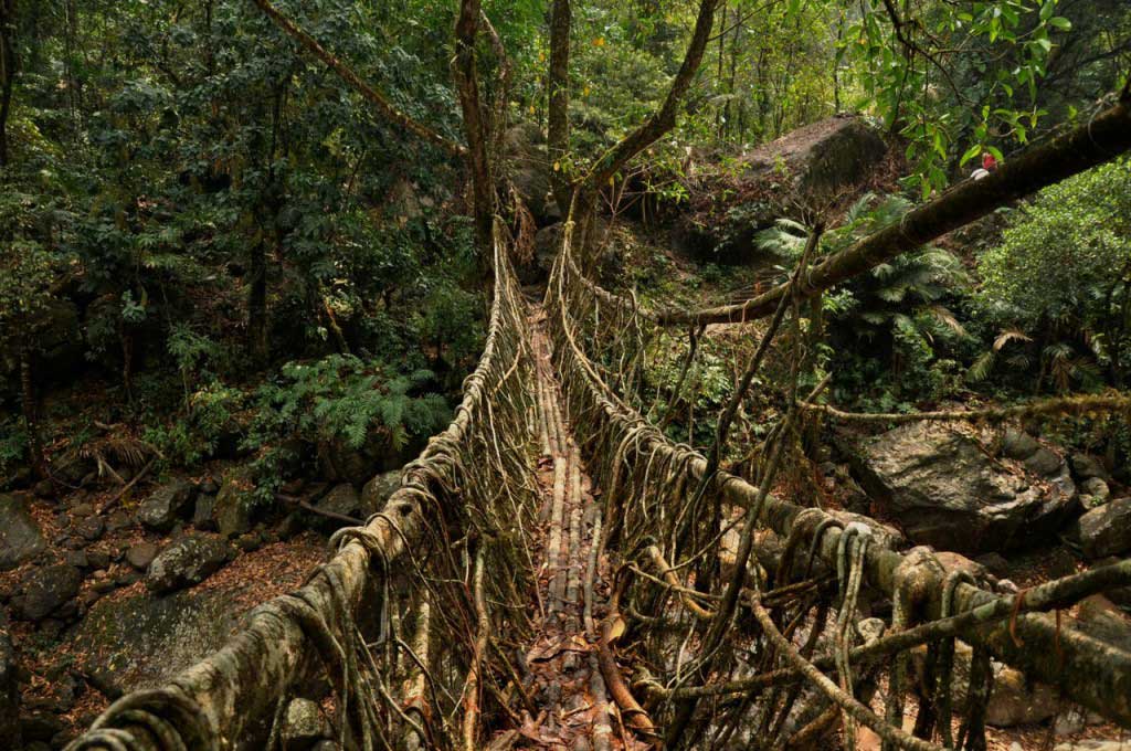
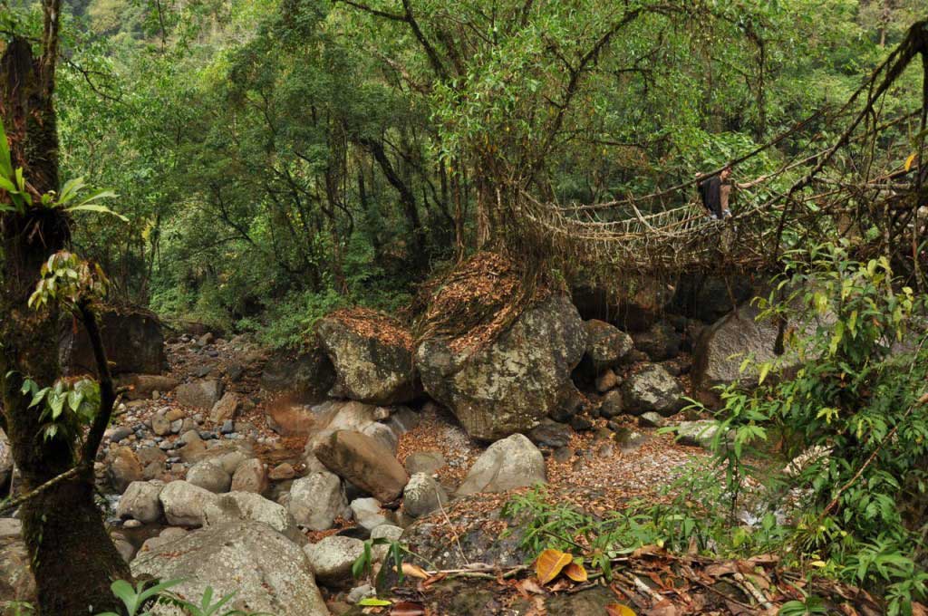
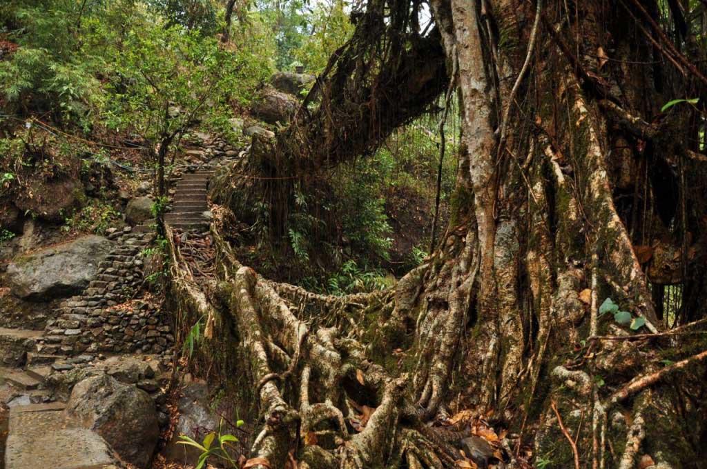
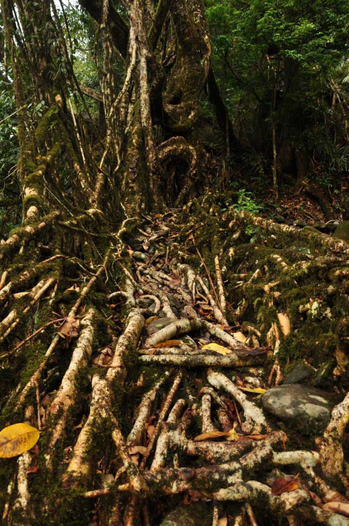
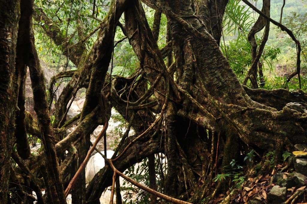
The enchanted forest where grow bridges made of tree roots, where time seems suspended in a dream, where nature does magic tricks, where the light gets filtered through the ceiling formed by the treetops, where we are transported to another dimension, as if we had entered in a world where fairies and gnomes watch us through mosses and raindrops.

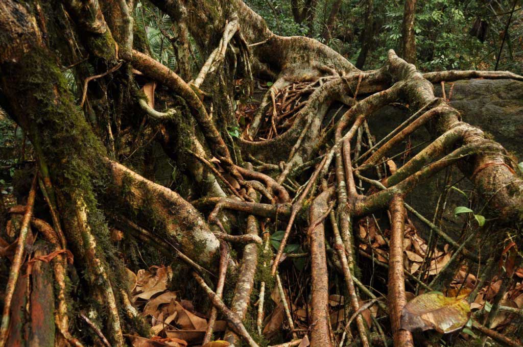
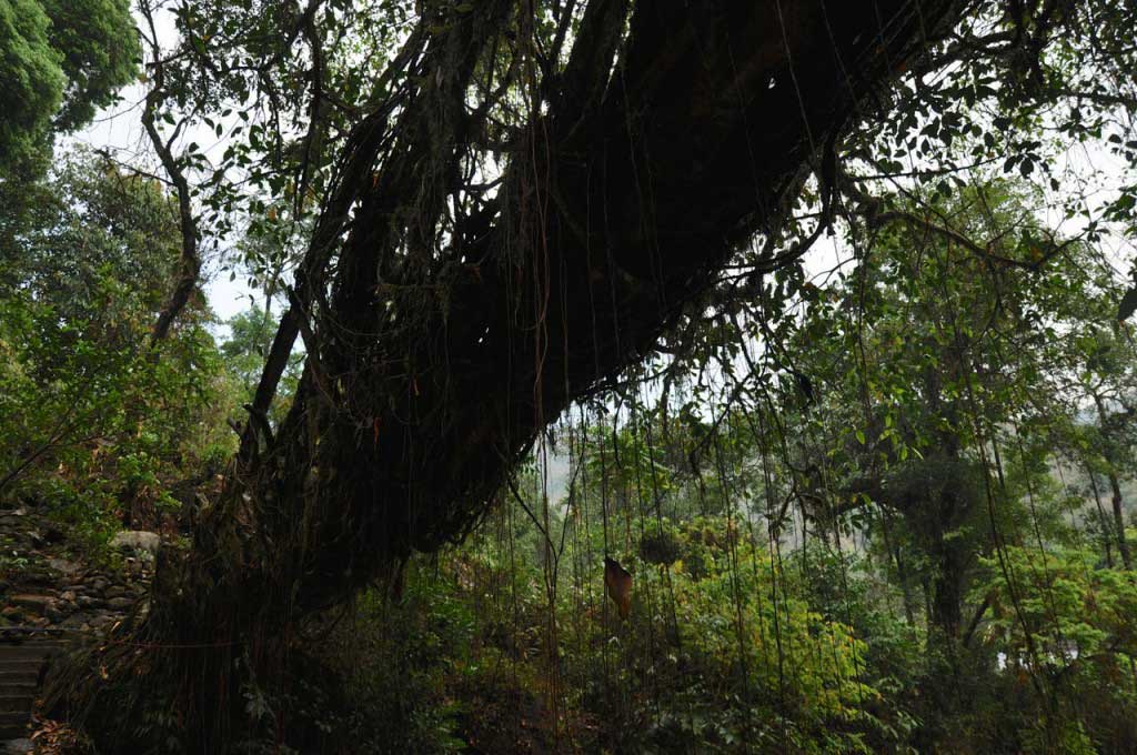
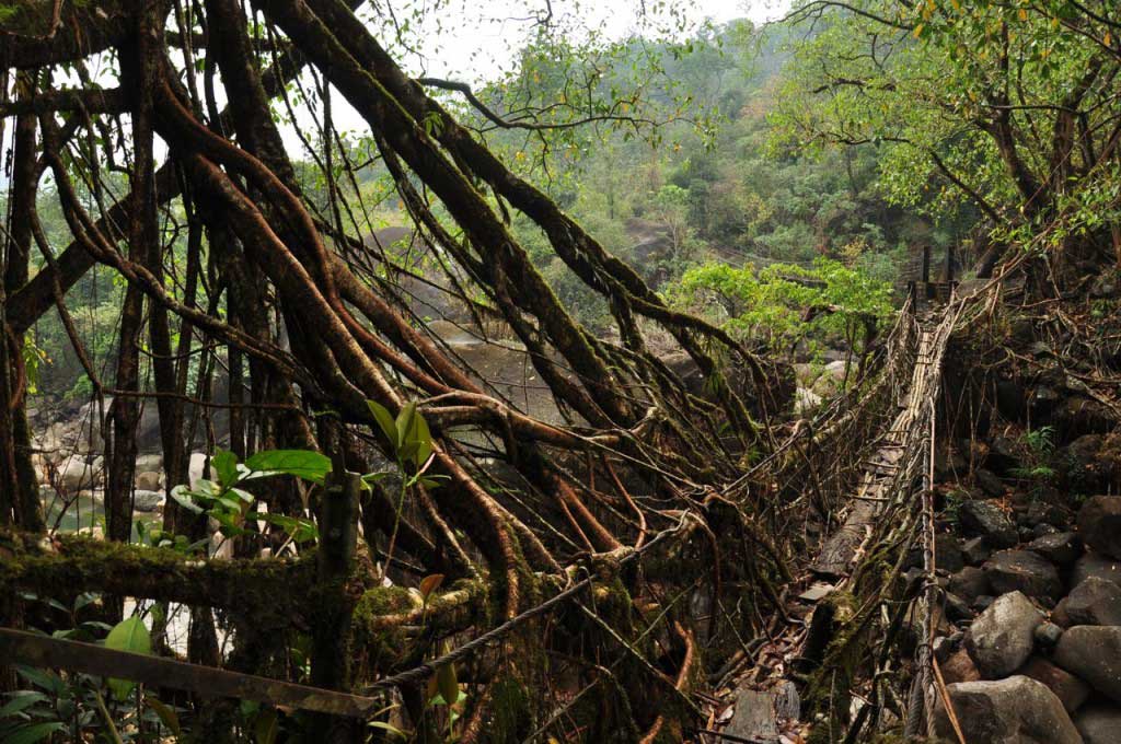
The bridges created by the patient hand of man, seem to come directly from the trees, as if they had decided to reach out to the other side of the river, merging with stones and relying on the trunks. A discrete layer of moss and lichen cover the surface form by these living structures, a shelter for insects and tiny animal life, which seems indifferent to human engineer skills.

But not only the bridges make this place special. The surrounding landscape, which adds the fantastic atmosphere that is perceived in the middle of the forest, from where emanates such energy, able to rejoin the man to our primordial roots, catalyzing the exchange of energies.

There are no words to describe the magic of this place… and the photos can only give a visual impression, not containing the forest energy, with the harmonious nature sounds, neither the sensations that flood our senses, making the memories of days spent in Nongriat a dreamlike memory.

… A place where we are observed by fairies, goblins, elfes and gnomes!


Living root bridges. Nongriat. Megahlaya


Living root bridges. Nongriat. Megahlaya


Living root bridges. Nongriat. Megahlaya


Living root bridges. Nongriat. Megahlaya


Living root bridges. Nongriat. Megahlaya


Living root bridges. Nongriat. Megahlaya


Living root bridges. Nongriat. Megahlaya


Living root bridges. Nongriat. Megahlaya


Living root bridges. Nongriat. Megahlaya


Living root bridges. Nongriat. Megahlaya


Living root bridges. Nongriat. Megahlaya


Living root bridges. Nongriat. Megahlaya


More about Nongriat living root bridges:

The living root bridges are work of human engineering, when man learn how to take advantage of nature, in a perfect harmony. Taking advantage of the long aerial roots of an endemic tree (ficus erratica), the local population intertwining these roots with logs and bamboos, along generations, creating vegetable bridges to cross the rivers that run through the valleys of Khasi Hills.

Each one of these bridges, adapts perfectly to the site, seem to merge with nature. Going down the hill towards Nongriat, the Jingkieng Pi-Tymmen bridge, the longest of this root bridges. After crossing Nongriat village we arrive at the famous double-deck bridge, whose two levels resulting from the need to cross the river when the monsoon rains make the river submerge the lower level of the bridge. Walking towards the Rainbow Waterfall we cross the Maw Saw bridge, that has the most mysterious and fantastic atmosphere.

There are several bridges made from roots of the ficus tree in Khasi Hills, but Nongriat has the privilege to have a higher number, making this village a good base for exploring paths and discover other living root bridges.


Living root bridges. Nongriat. Megahlaya


Where to stay in Nongriat:

http://steppingoutofbabylon.com/en/2016/07/nongritat-and-the-living-root-bridges/

Where to eat in Nongriat:

http://steppingoutofbabylon.com/en/2016/07/nongritat-and-the-living-root-bridges/

How to go from Sohra (Cherrapunjee) to Nongriat:

http://steppingoutofbabylon.com/en/2016/07/nongritat-and-the-living-root-bridges/

Nongritat and the living root bridges

Magic. Dream. Unreal.

Words that show up in my mind when I recall Nongriat.

Nongriat
Nongriat


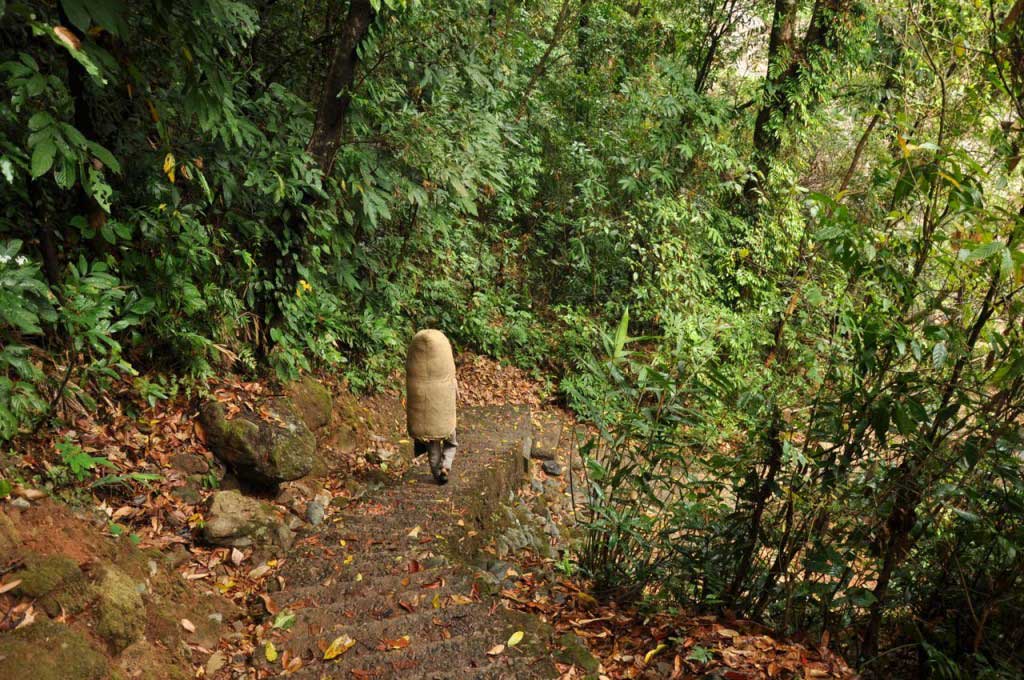
The rain, though predictable, unexpectedly began as we start the descent to the village of Nongriat, forcing to some breaks for tea and rest in modest bamboo huts. But what was coming to be an inconvenience proved to be a blessing, with the vegetation gaining a glow that gives greater vividness and contrast to the green nuances that fill entirely the horizon.

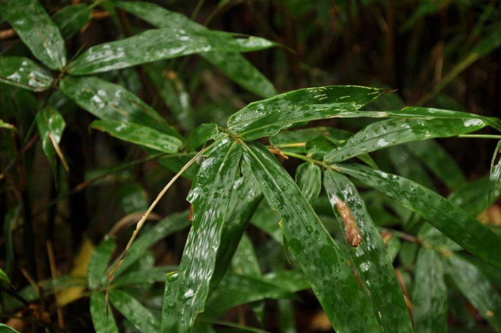
As the sound of drops of rain goes away, turn the shy sounds of the jungle, with an invisible orchestra formed by frogs and insects. Mosses and lichens show with all its power, absorbing water drops that slowly give off the bamboo leaves, which seem to bend under the weight of water.

a caminho de Nongriat
on the way to Nongriat


a caminho de Nongriat
on the way to Nongriat


a caminho de Nongriat
on the way to Nongriat


Despite having lost the title of rainiest place in the world, resulting from the persistent deforestation, both to feed the timber industry or as fuel for the local population, Nongriat and the surrounding region of Mawsynram and Cherrapunjee in East Khasi Hills, continue to show a high rainfall. Even out of the monsoon (July and August) heavy rains are frequent, which during the so-called dry season only lasts a few minutes. From this semi-tropical climate, resulting in a lush and diverse vegetation: giant trees, palm trees, bamboos, ferns and ficus, whose aerial roots are indispensable to the construction of footbridges, which make so many people come to Nongriat.

Nongriat. Megahlaya


Nongriat
Nongriat


bay leaves porter. Nongriat


Nongriat. Megahlaya


 The night arrives early in the valley, with green slopes and be lost as the blue sky surrenders to the night, leaving the village in almost total darkness, interrupted here and there by the faint glow of electricity that reaches every home. It’s this darkness that makes me realize how far I’m from the so-called civilization and how comfortable can be this simple and modest lifestyle, where the contact with nature brings a deep calm and tranquility.

Enjoying the freshness brought by night, we are naturally invited to share the calm evening with the other guests, surrounded by the dark cloak of night. But an unexpected glow, with an unusual intensity, emerges from behind the mountains, drawing ever more clearly the top of the contours of the hilltop, in the opposite of the village. It is the show of moonrise, that here with the full moon night, offers a magical view that makes all people stare, creating a space of quietness in the cross talk of the guests.


Kashi Hills. Megahlaya


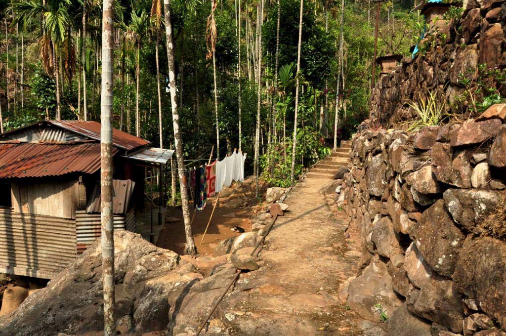
Nongriat is one of the hundreds of villages that are located on the slopes of the East Kashi Hills, and due to the isolation remain the traditional way of life of Kashi tribe almost intact. A lifestyle based on collecting product directly in the forest and sold them in Sohra market, that attracts people from that region every Wednesday. The forest provides pepper, bay leaf, betel nut, cinnamon, lemon juice… pineapples grow spontaneously a little everywhere, jackfruit abounds in the tree trunks, and around the village there’s beehive whose honey is also a business that supports the local economy. Porters go up and down the slopes bringing forest products and return with food and other products necessary for the simple life of this population of 150 people, where apparently the majority are children.

Nongriat. Megahlaya


Porter carrying bay leaves picket at the forest to be sold at Sohra weekly market


Vila de Nongriat
Nongriat village


It’s the laugh of children in their restless plays that fills the air of the village, where is strange the absence of birds, monkeys and other animals. Early morning, in upright school uniform, the children forward to the village primary school, while the older ones need to climb the slope to take classes in Tyrna and Sohra. Despite the isolation and rural environment of this region, which could lead to a lack of interest in school, education is taken very seriously, with virtually all children going to school and learn English, language that is spoken by the majority of the population, even in the most remote villages as Sohra.

The Christian church is also a strong presence here in Megahlaya, that due to the remote location, as well as Nagaland, remained impervious to Hinduism, but could not resist the Christianization in the nineteenth century, during the British presence in India, imposed by missionaries that found here a fertile ground between an animist population.

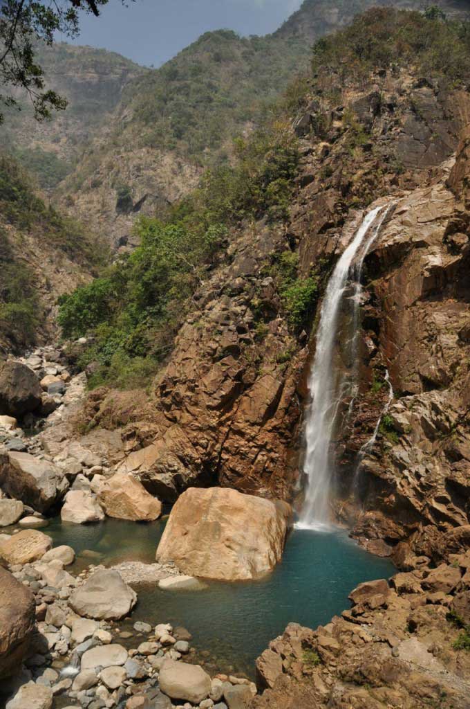
But Nongriat has more attractive than only the living root bridges, with several paths leaving from the village, some towards neighbouring village, who also hide other living bridges, others toward the waterfalls, being the Rainbow Waterfall the most popular destination. For those who want to bathe in the clear waters of this cascade, of an unusual blue, have to go down a steep path, but along the way, as well as in other parts of the rivers that surround Nongriat are several natural pools formed by granitic rocks along river bed, providing clear and calm waters for a refreshing bath, relieving the heaviness from warm and moist tropical air. During the monsoon is not allowed bathing in the river due to the force of the water.


uma das pontes suspensas junto à aldeia de Nongriat que dá acesso às Rainbow falls
suspension bridge along the way from Nongriat to the Rainbow falls


Rainbow falls. Nongriat. Megahlaya


Nongriat. Megahlaya

Hiking to Nongriat. practical information:


  • all the way is done along a very clear path, made in cement stairs that have fairly regular steps and it’s in good condition, as the result of financial funds to support the agricultural development of the region;
  • the descent is all done in steps until you reach the valley which then forces you to go through some metal suspension bridges; there are between 2500-3000 steps until Nongriat;
  • the descent is not difficult, but the hot and humid climate, causing a constant perspiration, make the most tiring journey;
  • the climb up is intense, forcing a few stops that are always a good time to enjoy the view; enough water is required in particular for the ascending path;
  • the descent takes less than 1.5 hours, with some stops for enjoying the views and rest, but the way up can take almost the doubled;
  • recommended to take the minimum weight in the backpack, it is advisable to leave most of the luggage at the guest house in Sohra.
  • if it rains a raincoat doesn’t prove to be effective because it causes, even more, sweat; it is better to have quickly dry clothes;
  • You do not need special shoes, some comfortable sandals serve perfectly, as all the way is cemented.
  • after Nongritat, if you wish to explore surrounding villages, hiking shoes may be more comfortable, but the sandals cover the needs if they have good grip in wet conditions;
  • it is recommended to stay at least one night Nongriat, to have the chance of visit more bridges, waterfalls and natural pools, away from the busiest trail;
  • during the weekend the number of visitors significantly increases, so it is best to arrive on Sunday and leave on the next Saturday morning, avoiding the noise and confusion and the view of the trash caused by irresponsible visitors who blindly seek “double deck bridge” just for the perfect selfie, totally unaware of the environment!!!


caminho para Nongriat


Where to stay in Nongriat:

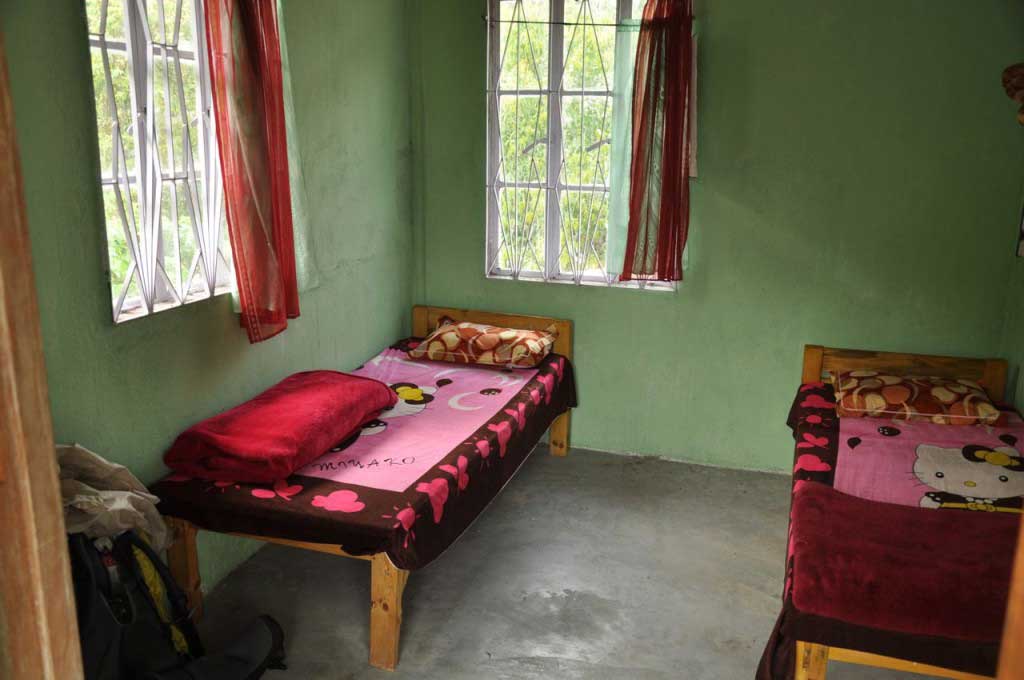
There are three homestays in Nongriat. The first is at the entrance of the village, after crossing one of the living root bridges, one in the center of Nongriat, and the last is located just after crossing the double deck bridge. The Serene Homestay is the most popular and which offers better conditions. There are double rooms and shared room, but all have shared toilet outside. Dinner is prepared for all guests and for everyone else that ordered, served in buffet style, with delicious vegetarian food made by the owner and his wife.

The Serene Homestay

Bed: 200 rupees per person, regardless of double or shared room.

Dinner: 130 rupees

The owner Ryan is a good source of information about trails, pools and other villages and bridges in the valley, as also about the way of life and local culture. His environmental awareness and good English make Ryan the spokesman of Nongriat and neighbouring villages, who come together to prevent the government to open a road to the valley. This so-called “progress” would destabilize the socio-economic way of life and would have environmental consequences resulting from the increase in visitors.

Serene Homestay, em Nongriat


Serene Homestay, em Nongriat


Where to eat in Nongritat:

Any of homestays in Nongriat serves food as well as the huts near the two roots bridge existing in Nongriat. However, it is a very simple food, mainly rice and dal… and chicken.

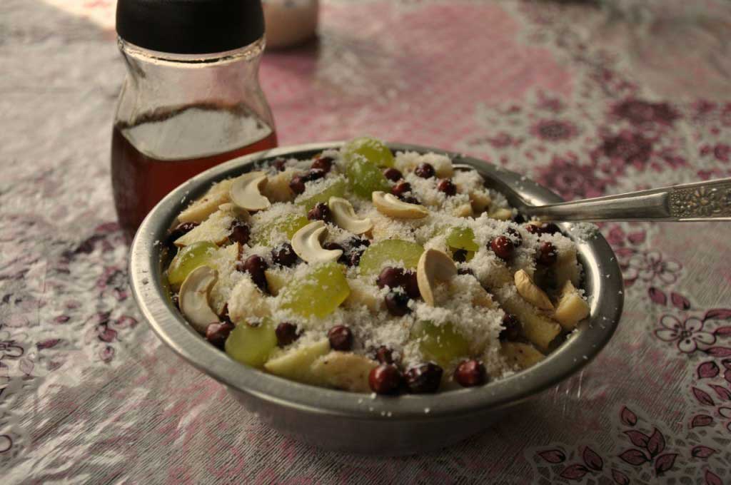
The best option is the Serene Homestay, with vegetarian food. The breakfast with porridge, fruit and nuts are delicious. Dinner (130 rupees) is served in buffet style, both for homestay guests as for who order in advance, and it is a great opportunity to socialize with other travelers.


pequeno-almoço no Serene Homestay, em Nongriatpequeno-almoço no Serene Homestay, em Nongriat
How to go from Sohra (Cherrapunjee) to Nongriat:

In front of the By the Way Lodge, there is a bus stand where around 9 am stops a bus bound for Tyrna, the nearest town of Nongriat with road access … from now on there are only paths down the mountain slopes to the villages located along the valley.

  • Bus Sohra to Tyrna (20 rupees) passes around 9 am, the trip takes about 1 hour)
  • shared-taxi Sohra to Tyrna: 40 rupees
  • in Tyrna is necessary to walk the road to find the path that leads to Nongriat, about 30 minutes walk down the road. Just go asked for “Nongriat” the local population because everyone knows the way, even the children.
  • Coming to a small cluster of houses, where there is a shop chai made in bamboo, the trail to Nongriat is on the left side that second account has more than 2,800 steps and a few suspension bridges until reaching Nongriat.


Bus de Sohra para Tyrna


Tyrna
Tyrna

Cherrapunjee… the wettest place on earth?!

Cherrapunjee or Sohra?!?!?!?… the first name is the “official” and is the one on the maps, the second name is by which this village, situated on a plateau near the Khasi Hills, is known by the local population, belonging to Khasi tribe.

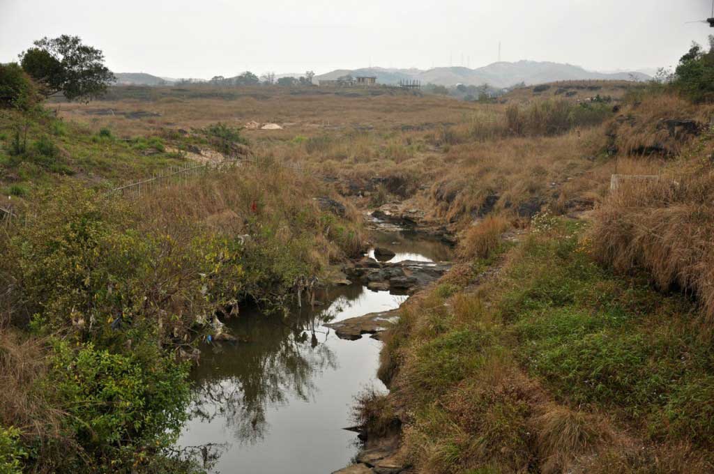
At this time of year, when the monsoon rains are a distant memory, only streams slide the bedrock of this plateau, where the green grass surrenders to dryness, changing to yellow tones.

After leaving behind the gray city of Shillong, and traveling by the winding road of rural landscapes and mountains of profuse vegetation, where we witness the bucolic but hard rural life, one comes to the desolate village of Sohra. The arrival on Sunday morning, with the sky covered with a soft blanket of gray clouds, the shops closed, streets empty of people and roads deserted of traffic, left a gloomy impression that even the next day, with the sun shining in a blue sky, could not erase.

Sohra (Cherrapunjee)
Sohra
Sohra (Cherrapunjee)

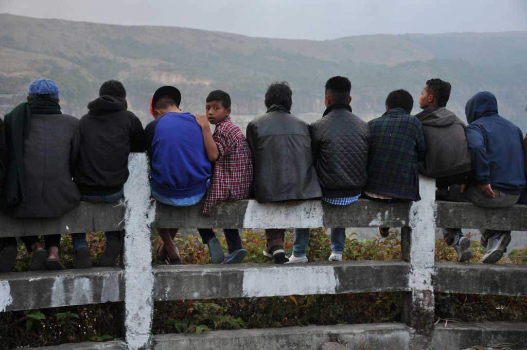
In a region heavily dominated by Christianity, in different forms, Christians, Anglicans, Protestants, Evangelicals, Presbyterians, etc…, the Sunday is entirely reserved for church. By midmorning, the deserted streets of Sohra, are gaining some colorful, with people walking towards the various churches in fancy clothes, where men dress impeccably ironed shirts, women wear lungis made from sophisticated fabrics, girls wear proudly pompous and colorful dresses and hair carefully combed, with fancy ties.

Situated on a plateau of the Khasi Hills, about 1400 meters above sea level, Sohra suffers from desertification, in an area where agriculture is difficult in a field depleted by erosion resulting from logging, which caused already visible climate change that made this place, formerly called “wettest place on earth,” has lost this title.

Kashi festival, Sohra (Cherrapunjee)

However Shora is obligatory passage point for those exploring the slopes of the Khasi Hills, and also serves as a technical stopover for those who want to come down to the valleys, where inhabitants keep the traditional way of life of Khasi culture. The village of Nogriat stands out by the fantastic bridges made from living tree roots: the living root bridges.

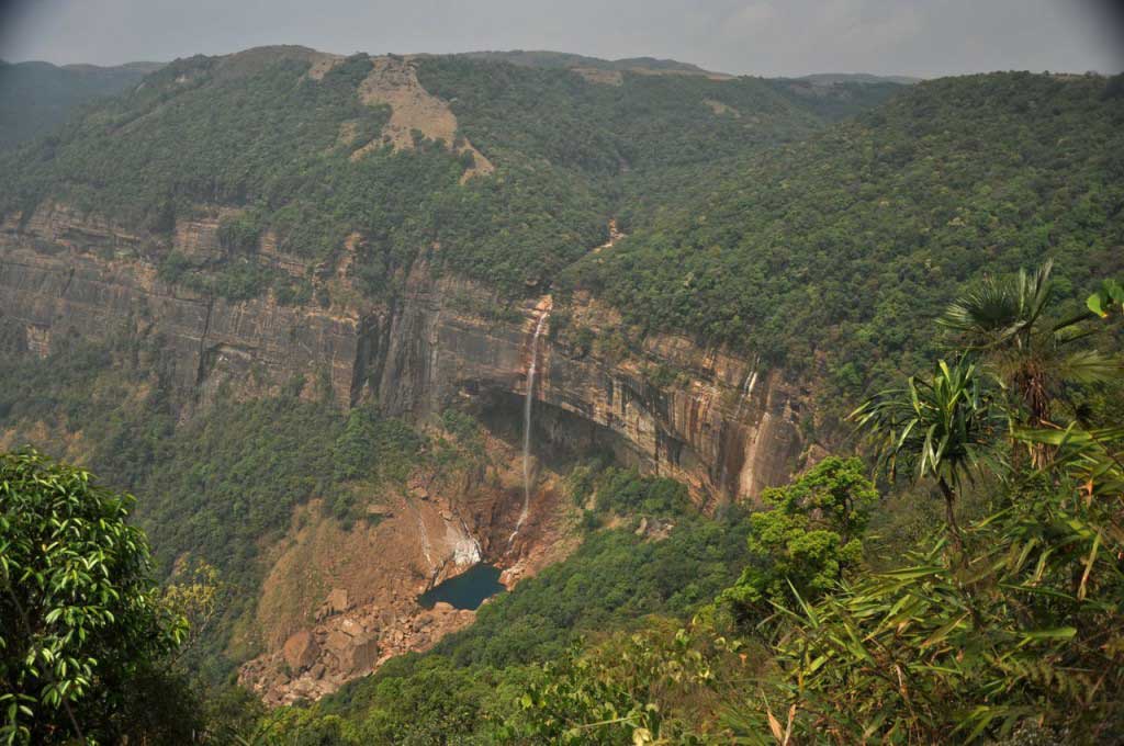
There is little to do or see in Sohra, but the day can be used for a visit to Nohkalikai Falls, 5 kilometers Sohra Market. In April, the amount of water in the rivers is not abundant, but still, a visit to the falls provides an interesting walk and a view of the chain of hills that extends to the Bangladesh border.

Nohkalikai Falls. Sohra (Cherrapunjee)

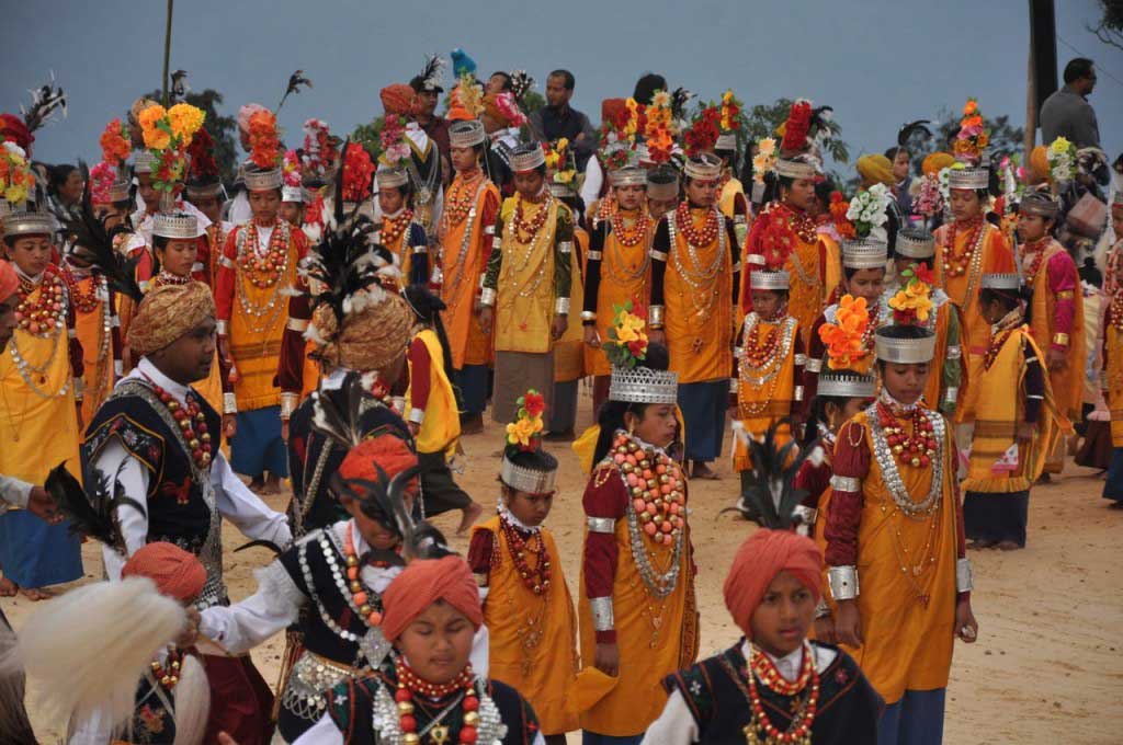
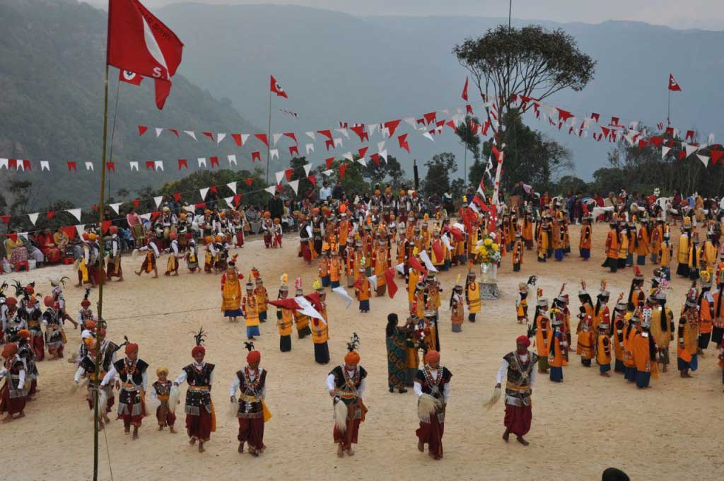
The stay of a day Sohra gave the opportunity to watch the last three days of a festival, where children and adults, wearing traditional costumes, performed dances to the sound of a minimalist and repetitive music.

Kashi festival, Sohra (Cherrapunjee)

Nohkalikai Falls:

Ticket: 10 rupees + 20 rupees for camera.

There isn’t a public transportation to the waterfalls, so the option is to get a taxi (300 rupees) or try to hitchhiking.

Tarifas. Nohkalikai Falls. Sohra (Cherrapunjee)
Entry fees to Nohkalikai Falls. Sohra (Cherrapunjee)

Onde dormir em Sohra:

There are several options in terms of accommodation in Sohra, but most are located in Lower Cherrapunjee, in an area where the houses are a bit spread, about 3 kilometers from Sohra Market, the town center.

Of the various accommodations available the choice was for the unassuming By the Way Lodge, where the owner, who looks more like a Rastafarian, welcomes us with kindness, providing all the information.

There are two dorms and a few rooms. The toilet and shower (with hot water) are shared and located outside the room, as the local custom, but are modern and spotlessly clean. There’s a good atmosphere and is the ideal place to meet other backpackers and rest, before and after, the demanding way to Nongriat. You can leave part of the luggage at the By the Way Lodge.

By the Way Lodge (Dukan Road, Lower Cherrapunjee). Nearby Indian Petrol Pump station. Less than 500 meters from the last sumo stand.

Dorm: 250 rupees

The By the way hostel is located close to India Petrol pump station. Less than 500 meters from the last stop of sumo in Lower Cherrapunjee.

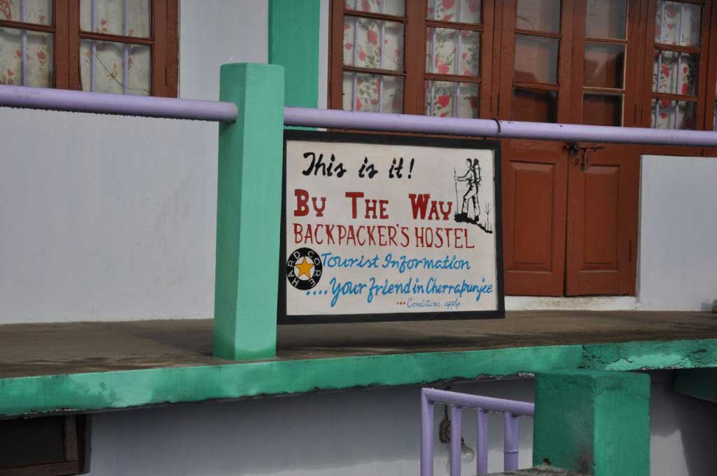
By the Way Backpackers Hostel. Sohra (Cherrapunjee)

Lower Cherrapunjee does not have much to offer than some restaurants and accommodations, but is a large area of natural landscape, that right after the monsoon is totally green and crossed by streams, but in March starts to get dry. But the By the Way Lodge and the friendliness of its owner are more than enough reasons to choose to stay in Lower Cherrapunjee before going to Nongriat.

Where to eat in Sohra (Cherrapunjee):

Meghalaya cuisine, not being friendly to vegetarians, is possible to find the traditional dishes of Indian cuisine, as also some Asian vegetarian option the Lower Cherrapunjee restaurants.

7 Trep Restaurant: Good Indian food. A curry with a rich variety of vegetables served in a generous portion and served with a big bowl of rice only costs 70 rupees. The noodles and momos are the favorites of the local population. The food is cooked at the moment, which may take a while. The staff is very friendly.

Sunday everything is closed in Sohra Market, but some restaurants are open in Lower Cherrapunjee.

But for those who want to get an early start, there are few options for breakfast. There a few small shops, a mixture of coffee and groceries, serving milk-tea and meals, based mainly on rice and meat, from 8.30 in the morning.

um restaurante local em Sohra (Cherrapunjee)
local restaurant, Sohra (Cherrapunjee)
pequeno-almoço num restaurante local em Sohra (Cherrapunjee)
rice and chickpeas as a breakfast at a local restaurant, Sohra (Cherrapunjee)

Transports in Sohra (Cherrapunjee):

To cover the three kilometers separating Lower Cherrapunjee from Sohra Market there are shared-taxis (locally called “tempo”) picking up and dropping passengers, along the road, without any specific place. Usually you have to wait until they are nearly full to do the trip. The tempo are small cars (Maruti Suzuki) painted in black and yellow.

  • Shared taxis Lower Cherrapunjee to Sohra Market: 10 INR
paragem de "sumos" em Lower Cherrapunjee
“sumo” stand at Lower Cherrapunjee

How to go from Sohra (Cherrapunjee) to Nongriat:

In front of the By the Way Lodge, there is a bus stand where the 9 am passes a bus bound for Tyrna, the nearest town of Nongriat with road access… from there are only paths down the mountain to the villages located along the valley.

  • Bus Sohra to Tyrna 20 (INR passes around 9 am, the trip takes close to 1 hour)
  • shared-taxi Sohra to Tyrna: 40 INR
  • in Tyrna is necessary to walk the road to find the path that leads to Nongriat, about 30 minutes walk down the road. Just asked for “Nongriat” to the local population because everyone knows to show the way, even the children.
  • arriving to a small group of houses where there is a bamboo chai-shop, the trail to Nongriat, that has more than 2,800 steps and a few suspension bridges until reaching the village.

ATM in Sohra:

There is no ATM in Lower Cherrapunjee, next to the petrol station, on the Dukan Road, as well as in Sohra Market.

There is no ATM in Tyrna or Nongriat.

How to go from Sohra (Cherrapunjee) to Shilllong:

Both in Lower Cherrapunjee as in Sohra Market, sumos (shared jeeps with yellow color) link daily (except Sundays) Sohra to Shillong. They work from dawn until the end of the day. The trip starts when the tempo is full.

  • sumo from Sohra to Shillong: 70 INR (1.5 hours)

elevation: 1484 m

population: 14.816

  • « Go to Previous Page
  • Page 1
  • Page 2
  • Page 3
  • Page 4
  • Page 5
  • Page 6
  • Interim pages omitted …
  • Page 8
  • Go to Next Page »

Footer

search

Tags

Amed Arugam Bay Assam Bali Bogor Border Crossing Borneo Colombo Esfahan Fes Food Gilis Hiking Hikkaduwa hokkaido Istanbul Itinerary Jakarta Java Kashan Kohima Kumano Kodo Lombok Marrakesh Meghalaya Meknes Mekong Nagaland Natural Park Northeast States Ouarzazate Sarawak Shan State Shiraz Sichuan Province Sumatra Tabriz Tehran transportation Varanasi Visa Yangon Yazd Yogyakarta Yunnan Province

I’m Catarina, a wanderer from Lisbon, Portugal… or a backpack traveller with a camera!

Every word and photo here comes from my own journey — the places I’ve stayed, the meals I’ve enjoyed, and the routes I’ve taken. I travel independently and share it all without sponsors or ads, so what you read is real and unfiltered.

If you’ve found my blog helpful or inspiring, consider supporting it with a small contribution. Every donation helps me keep this project alive and free for everyone who loves exploring the world.

Thank you for helping me keep the journey going!

BUY ME A COFFEE

Categories

Recent Posts:

  • How to go from Hualien to Dulan Beach
  • Taroko Gorge: between marble cliffs and emerald rivers
  • Hualien: a dull gateway to Taroko Gorge
  • Taiwan: Itinerary for an 16 day trip
  • Vietnam: Itinerary
  • 3 months in India: Kolkata, Tamil Nadu, Karnataka, Goa and Kerala
  • Backpacking Turkey in 24 Days: itinerary & costs
  • English
  • Português

© Copyright 2026 Stepping out of Babylon · All Rights Reserved · Designed by OnVa Online · Login